Area Overview for OX7 3DW
Photos of OX7 3DW
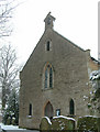
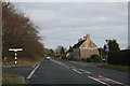
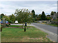
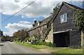
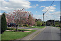
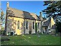
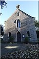
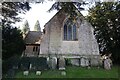

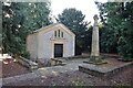
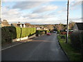
21 photos from this area
Area Information
Key information about the OX7 3DW including its size, population, and administrative classification.
- Area Type
- Postcode
- Area Size
- 5.2 hectares
- Population
- 1153
- Population Density
- 114 people/km²
House Prices in OX7 3DW
20
Properties
£413,545
Average Sold Price
£84,000
Lowest Price
£900,000
Highest Price
Showing 20 properties
| Address | Type | Beds | Baths | Last Sale Price | Last Sale Date | |
|---|---|---|---|---|---|---|
| The Burrows, 58A High Street, Finstock, OX7 3DW | Detached | 4 | 2 | £800,000 | Aug 2023 | |
| Sheepstor, 36 High Street, Finstock, OX7 3DW | house | 4 | 2 | £900,000 | Feb 2022 | |
| Skippett House, 72 High Street, Finstock, OX7 3DW | Detached | 4 | 2 | £675,000 | Aug 2020 | |
| 60 High Street, Finstock, OX7 3DW | Cottage | 3 | 1 | £435,000 | Sep 2018 | |
| 62 High Street, Finstock, OX7 3DW | Detached | 4 | 2 | £475,000 | Jan 2015 | |
| Wychwood Cottage, 64 High Street, Finstock, OX7 3DW | Bungalow | 3 | - | £300,000 | Jul 2013 | |
| 46 High Street, Finstock, OX7 3DW | Detached | - | - | £280,000 | Jun 2005 | |
| 60A High Street, Finstock, OX7 3DW | Detached | - | - | £265,000 | Jan 2001 | |
| 74 High Street, Finstock, OX7 3DW | Detached | - | - | £180,000 | Mar 2000 | |
| 68 High Street, Finstock, OX7 3DW | Detached | - | - | £84,000 | Sep 1996 |
Page 1 of 2
Energy Efficiency in OX7 3DW
Amenities
Schools
| Rank | School | Type | Entry gender | Ages |
|---|
Explore more schools in this area
Go to Schools tabDemographics
Household Size
Two person
most common
Accommodation Type
Houses
most common
Tenure
80
majority
Ethnic Group
White
most common
Religion
N/A
most common
Household Composition
N/A
most common
Age
47
median
Adults (30-64 years)
most common
Household Deprivation
N/A
with no deprivation
NS-SEC
42
in Lower managerial occupations
Explore more demographic insights in this area
Go to Demographics tabPlanning
Planning Constraints
- Flood RiskPremium
- Ramsar Wetland SitesPremium
- Area of Outstanding Natural BeautyPremium
- Protected Nature ReservePremium
- Protected WoodlandPremium