Area Overview for OX7 3BA
Photos of OX7 3BA
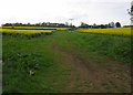

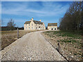
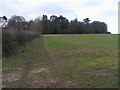
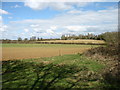
5 photos from this area
Area Information
Key information about the OX7 3BA including its size, population, and administrative classification.
- Area Type
- Postcode
- Area Size
- 52.9 hectares
- Population
- 1108
- Population Density
- 81 people/km²
House Prices in OX7 3BA
30
Properties
£507,545
Average Sold Price
£178,500
Lowest Price
£1,512,315
Highest Price
Showing 30 properties
| Address | Type | Beds | Baths | Last Sale Price | Last Sale Date | |
|---|---|---|---|---|---|---|
| Oakdene, Wilcote Lane, Ramsden, OX7 3BA | house | - | - | £1,200,000 | Jun 2025 | |
| 6 Wilcote Lane, Ramsden, OX7 3BA | house | - | - | £280,000 | Feb 2021 | |
| Sarahs Cottage, Wilcote Lane, Ramsden, OX7 3BA | Semi-detached | 3 | 1 | £362,500 | Jun 2019 | |
| Fox Cottage, Wilcote Lane, Ramsden, OX7 3BA | Cottage | 4 | 2 | £635,000 | Sep 2018 | |
| Green Pastures, Wilcote Lane, Ramsden, OX7 3BA | Terraced | 4 | 1 | £445,000 | Sep 2018 | |
| 4 Wilcote Lane, Ramsden, OX7 3BA | house | 3 | - | £442,000 | Sep 2018 | |
| Stonecrop, Wilcote Lane, Ramsden, OX7 3BA | Detached | 4 | 2 | £515,000 | Aug 2017 | |
| Gable Cottage, 3 Wilcote Lane, Ramsden, OX7 3BA | house | 2 | - | £300,000 | Oct 2016 | |
| Wilcote Place, Wilcote Lane, Ramsden, OX7 3BA | Detached | - | - | £895,000 | Aug 2016 | |
| Ladywell Cottage, Wilcote Lane, Ramsden, OX7 3BA | house | 4 | 2 | £500,000 | May 2014 |
Page 1 of 3
Energy Efficiency in OX7 3BA
Amenities
Schools
| Rank | School | Type | Entry gender | Ages |
|---|
Explore more schools in this area
Go to Schools tabDemographics
Household Size
Two person
most common
Accommodation Type
Houses
most common
Tenure
82
majority
Ethnic Group
White
most common
Religion
N/A
most common
Household Composition
N/A
most common
Age
47
median
Adults (30-64 years)
most common
Household Deprivation
N/A
with no deprivation
NS-SEC
45
in Lower managerial occupations
Explore more demographic insights in this area
Go to Demographics tabPlanning
Planning Constraints
- Flood RiskPremium
- Ramsar Wetland SitesPremium
- Area of Outstanding Natural BeautyPremium
- Protected Nature ReservePremium
- Protected WoodlandPremium