Area Overview for OX26 5EA
Photos of OX26 5EA
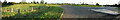
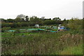
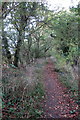
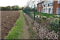
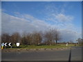
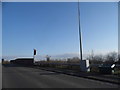
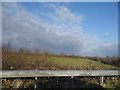
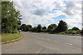
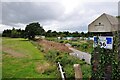
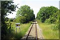

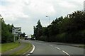
15 photos from this area
Area Information
Key information about the OX26 5EA including its size, population, and administrative classification.
- Area Type
- Postcode
- Area Size
- 8.7 hectares
- Population
- 1979
- Population Density
- 108 people/km²
House Prices in OX26 5EA
40
Properties
£273,167
Average Sold Price
£92,500
Lowest Price
£520,000
Highest Price
Showing 40 properties
| Address | Type | Beds | Baths | Last Sale Price | Last Sale Date | |
|---|---|---|---|---|---|---|
| 38 Blenheim Drive, Launton, OX26 5EA | Bungalow | 2 | 2 | £455,000 | Nov 2025 | |
| 3 Blenheim Drive, Launton, OX26 5EA | Bungalow | 4 | 1 | £320,000 | Sep 2025 | |
| 22 Blenheim Drive, Launton, OX26 5EA | Semi-detached | 2 | 1 | £305,000 | Feb 2025 | |
| 29 Blenheim Drive, Launton, OX26 5EA | Bungalow | 2 | 1 | £275,000 | Feb 2025 | |
| 25 Blenheim Drive, Launton, OX26 5EA | Bungalow | 3 | 1 | £325,000 | May 2022 | |
| 24 Blenheim Drive, Launton, OX26 5EA | Retail | 3 | - | £375,000 | Mar 2022 | |
| 34 Blenheim Drive, Launton, OX26 5EA | Bungalow | - | - | £420,000 | Oct 2021 | |
| 33 Blenheim Drive, Launton, OX26 5EA | Bungalow | 2 | 1 | £385,000 | Mar 2021 | |
| 14 Blenheim Drive, Launton, OX26 5EA | Semi-detached | 2 | 1 | £276,000 | Mar 2020 | |
| 7 Blenheim Drive, Launton, OX26 5EA | Bungalow | 2 | 1 | £300,000 | Feb 2019 |
Page 1 of 4
Energy Efficiency in OX26 5EA
Amenities
Schools
| Rank | School | Type | Entry gender | Ages |
|---|
Explore more schools in this area
Go to Schools tabDemographics
Household Size
Two person
most common
Accommodation Type
Houses
most common
Tenure
80
majority
Ethnic Group
White
most common
Religion
N/A
most common
Household Composition
N/A
most common
Age
47
median
Adults (30-64 years)
most common
Household Deprivation
N/A
with no deprivation
NS-SEC
42
in Lower managerial occupations
Explore more demographic insights in this area
Go to Demographics tabPlanning
Planning Constraints
- Flood RiskPremium
- Ramsar Wetland SitesPremium
- Area of Outstanding Natural BeautyPremium
- Protected Nature ReservePremium
- Protected WoodlandPremium