Area Overview for OX26 5DP
Photos of OX26 5DP

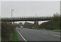
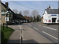
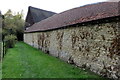


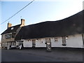
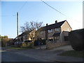


49 photos from this area
Area Information
Key information about the OX26 5DP including its size, population, and administrative classification.
- Area Type
- Postcode
- Area Size
- 14.4 hectares
- Population
- 1979
- Population Density
- 108 people/km²
House Prices in OX26 5DP
44
Properties
£398,409
Average Sold Price
£113,500
Lowest Price
£850,000
Highest Price
Showing 44 properties
| Address | Type | Beds | Baths | Last Sale Price | Last Sale Date | |
|---|---|---|---|---|---|---|
| Tenaya, Bicester Road, Launton, OX26 5DP | Detached | 4 | 2 | £850,000 | Aug 2023 | |
| 4 Bicester Road, Launton, OX26 5DP | house | 3 | 1 | £335,000 | Nov 2022 | |
| Old Paddock, Bicester Road, Launton, OX26 5DP | Detached | 4 | 1 | £530,000 | Jul 2022 | |
| 2, Church Cottages, Bicester Road, Launton, OX26 5DP | house | - | - | £625,000 | Mar 2022 | |
| The Chimes, Bicester Road, Launton, OX26 5DP | Retail | 3 | 2 | £520,000 | Feb 2022 | |
| Humberston, Bicester Road, Launton, OX26 5DP | Bungalow | 4 | 2 | £460,000 | Oct 2021 | |
| Cerney Cottage, Bicester Road, Launton, OX26 5DP | Detached | 4 | - | £505,000 | Mar 2021 | |
| Magnolia House, Bicester Road, Launton, OX26 5DP | Detached | 5 | 3 | £695,000 | Nov 2020 | |
| Bedfield, Bicester Road, Launton, OX26 5DP | Detached | 4 | 2 | £590,000 | Aug 2019 | |
| The Cottage, Bicester Road, Launton, OX26 5DP | Detached | 3 | 1 | £320,000 | Jan 2019 |
Page 1 of 5
Energy Efficiency in OX26 5DP
Amenities
Schools
| Rank | School | Type | Entry gender | Ages |
|---|
Explore more schools in this area
Go to Schools tabDemographics
Household Size
Two person
most common
Accommodation Type
Houses
most common
Tenure
80
majority
Ethnic Group
White
most common
Religion
N/A
most common
Household Composition
N/A
most common
Age
47
median
Adults (30-64 years)
most common
Household Deprivation
N/A
with no deprivation
NS-SEC
42
in Lower managerial occupations
Explore more demographic insights in this area
Go to Demographics tabPlanning
Planning Constraints
- Flood RiskPremium
- Ramsar Wetland SitesPremium
- Area of Outstanding Natural BeautyPremium
- Protected Nature ReservePremium
- Protected WoodlandPremium