Area Overview for OX26 5DX
Photos of OX26 5DX


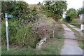

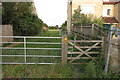


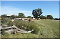
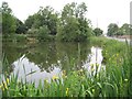
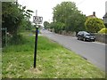
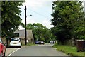

18 photos from this area
Area Information
Key information about the OX26 5DX including its size, population, and administrative classification.
- Area Type
- Postcode
- Area Size
- 27.0 hectares
- Population
- 1979
- Population Density
- 108 people/km²
House Prices in OX26 5DX
33
Properties
£655,846
Average Sold Price
£125,000
Lowest Price
£1,375,000
Highest Price
Showing 33 properties
| Address | Type | Beds | Baths | Last Sale Price | Last Sale Date | |
|---|---|---|---|---|---|---|
| The Pitches, Station Road, Launton, OX26 5DX | Semi-detached | 2 | 1 | £380,000 | Aug 2025 | |
| Laurels Farm, Station Road, Launton, OX26 5DX | Farm | 4 | 2 | £1,375,000 | Aug 2023 | |
| Box Tree Farm, Station Road, Launton, OX26 5DX | Detached | 3 | - | £825,000 | Nov 2021 | |
| Pound Croft, Station Road, Launton, OX26 5DX | Detached | 5 | 3 | £720,000 | May 2018 | |
| Home Farm House, Station Road, Launton, OX26 5DX | Detached | 4 | 2 | £1,075,000 | Jan 2018 | |
| The Martins, Station Road, Launton, OX26 5DX | Detached | 4 | 3 | £550,000 | Jan 2017 | |
| Squires House, Station Road, Launton, OX26 5DX | Detached | 4 | - | £590,000 | Aug 2012 | |
| Clock Court, Station Road, Launton, OX26 5DX | house | 4 | - | £760,000 | Feb 2012 | |
| Orchard View, Station Road, Launton, OX26 5DX | Detached | 6 | 3 | £280,000 | Oct 2010 | |
| Mareleys, Station Road, Launton, OX26 5DX | Detached | 4 | 2 | £495,000 | Feb 2008 |
Page 1 of 4
Energy Efficiency in OX26 5DX
Amenities
Schools
| Rank | School | Type | Entry gender | Ages |
|---|
Explore more schools in this area
Go to Schools tabDemographics
Household Size
Two person
most common
Accommodation Type
Houses
most common
Tenure
80
majority
Ethnic Group
White
most common
Religion
N/A
most common
Household Composition
N/A
most common
Age
47
median
Adults (30-64 years)
most common
Household Deprivation
N/A
with no deprivation
NS-SEC
42
in Lower managerial occupations
Explore more demographic insights in this area
Go to Demographics tabPlanning
Planning Constraints
- Flood RiskPremium
- Ramsar Wetland SitesPremium
- Area of Outstanding Natural BeautyPremium
- Protected Nature ReservePremium
- Protected WoodlandPremium