Area Overview for OX16 9DB
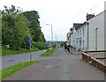
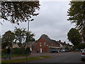
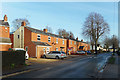
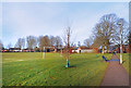
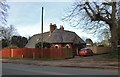
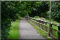
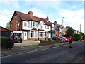
Photos of OX16 9DB


Area Information
OX16 9DB represents a specific residential cluster within the England postcode system, covering a modest footprint of 1950 square metres. This small, concentrated area supports a local population of approximately 1076 people. You are looking at a tightly knit neighbourhood where daily life revolves around immediate neighbours rather than sprawling suburban distances. The area functions as a distinct pocket of the wider region, offering a contained environment for those seeking a focused community experience. Living in OX16 9DB means navigating a space defined by its compact nature and established residential character. The character of this postcode is defined by its status as a specific residential cluster rather than a broad administrative zone. With a population density figure that indicates a significant concentration of residents within a limited square kilometre, you can expect a cohesive community atmosphere. The area is situated in England, far from the high-rise urban centres, focusing instead on traditional living patterns. Homes in OX16 9DB are part of this defined cluster, creating a setting where local interactions likely dominate the social fabric. Whether you prioritise privacy or community engagement, this area presents a clear, factual picture of what constitutes life here without the filler or hyperbole often found elsewhere. It is a place where the boundaries are clear, and the population is well-defined, allowing for a genuine understanding of the neighbourhood before you make any decisions about purchasing a property or relocating your family.
- Area Type
- Postcode
- Area Size
- 1950 m²
- Population
- 1076
- Population Density
- 3123 people/km²
The housing market in OX16 9DB is characterised by a significant majority of owner-occupied properties. Specifically, 70% of the housing stock is owned outright or with a mortgage, leaving only 30% as rental accommodations. This statistic dictates the nature of the local authority and the surrounding neighbourhood dynamics. You are dealing with a market where long-term residents hold the keys, rather than a transient rental sector dominating the landscape. This high level of ownership typically contributes to greater investment in property maintenance and community stability. The accommodation type is exclusively houses. There are no flats or apartments within this specific residential cluster. This means the housing stock consists of standalone homes, detached or semi-detached, designed for families or individuals seeking a traditional house environment. When searching for homes in OX16 9DB, you will not find urban-style flats but rather traditional residential houses. This preference aligns perfectly with the area's demographic profile of adults aged 30 to 64, who often require more space than a flat provides. The fact that the entire population of 1076 lives within these houses creates a uniform living standard across the postcode. For buyers, this certainty removes the guesswork; you know exactly what type of dwelling you are purchasing. The area is not a mixed-use zone with commercial blocks or high-density housing; it is a dedicated residential area of substantial homes.
House Prices in OX16 9DB
No properties found in this postcode.
Energy Efficiency in OX16 9DB
Daily life in OX16 9DB is supported by a range of amenities within practical reach of the residential cluster. Retail options are well represented, with five key locations offering shopping and leisure opportunities. You can access Sainsburys Banbury, Co-op Cherwell, and Morrisons Banbury to meet your daily grocery and shopping needs. The presence of both a large supermarket and a local convenience store ensures you have no long drives for weekly shoploads. Public transport links are equally accessible, with rail services available at Banbury Railway Station and Kings Sutton Railway Station. These two stations provide you with direct train connections to wider Oxfordshire and beyond without requiring a car for every journey. The proximity to these major retail chains and railway hubs means your lifestyle includes convenient access without the need for a car at all times. Living in OX16 9DB integrates well with the surrounding towns of Banbury and Kelmarsh, where Kings Sutton is located. You can visit multiple supermarkets within a short drive or train trip, ensuring variety in food choices and store loyalty schemes. The rail connections mean you can commute to Oxford or London efficiently during the week. The combination of local high-street variety via the supermarkets and regional holiday opportunities via the railway stations creates a balanced lifestyle. There are no parks or leisure complexes listed in the immediate data, so most leisure is likely enjoyed within the reach of these surrounding towns or at home.
Amenities
Schools
Education provision for families in OX16 9DB is centred around The Grange Community Primary School. This facility is located within practical reach of the postcode and serves as the key educational institution for the area. The school holds an Ofsted rating of good, providing verified quality assurance for parents considering the locality. You have access to a primary school with a recognised standard of teaching and care, which is essential for children attending local education facilities. At this stage, the data does not include secondary schools immediately adjacent to OX16 9DB. Families with older children will likely look beyond the immediate primary catchment or attend secondary institutions in wider Oxon. The presence of a primary school with a good rating indicates that young families residing in the area benefit from early access to quality education. The Grange Community Primary School serves the OX16 9DB community directly. While comprehensive data on school catchment boundaries is not provided, the existence of a single primary option with a strong rating suggests a focused educational environment. Parents should verify the specific catchment zone for their property against the school's current admissions policy, but the rating itself confirms a standard of proficiency. The school mix is currently singular at the primary level, meaning neighbours share a common educational starting point before children progress to secondary institutions in nearby towns.
| Rank | School | Type | Entry gender | Ages |
|---|
Explore more schools in this area
Go to Schools tabDemographics
The community profile of OX16 9DB is shaped by a mature demographic structure. The median age stands at 47 years, indicating a neighbourhood favoured by adults rather than young families or retirees alone. Specifically, adults aged 30 to 64 years represent the most common age range among residents. This concentration of mid-life adults suggests an area where stability and long-term settlement are prevalent. With a home ownership rate of 70%, the market is dominated by owners rather than renters. This high percentage signals that many families have put down roots and invested in their local environment. Accommodation in OX16 9DB consists primarily of houses. This preference for detached or semi-detached properties aligns with the older age profile and the high rate of home ownership. The predominant ethnic group is White, which reflects the traditional settlement patterns often found in such established postcodes. While specific data on deprivation indices is not provided in the available records, the high home ownership rate and mature age profile typically correlate with stable, established communities. The population density reaches 551,765 people per square kilometre, a figure that defines the intensity of the local housing environment. You are moving into an area where the housing stock is suited to those who value space and ownership. The demographic reality is one of stability, with a community built around adult householders who generally own their homes and settle in for the long term.
Household Size
Accommodation Type
Tenure
Ethnic Group
Religion
Household Composition
Age
Household Deprivation
NS-SEC
Explore more demographic insights in this area
Go to Demographics tabPlanning
Planning Constraints
- Flood RiskPremium
- Ramsar Wetland SitesPremium
- Area of Outstanding Natural BeautyPremium
- Protected Nature ReservePremium
- Protected WoodlandPremium