Area Overview for OX16 9AJ
Photos of OX16 9AJ
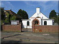
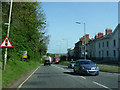
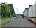
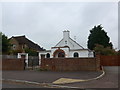
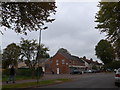
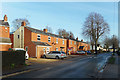
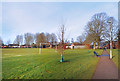
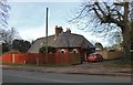
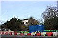
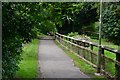
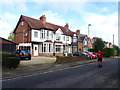
97 photos from this area
Area Information
Key information about the OX16 9AJ including its size, population, and administrative classification.
- Area Type
- Postcode
- Area Size
- 4.1 hectares
- Population
- 1460
- Population Density
- 4806 people/km²
House Prices in OX16 9AJ
57
Properties
£504,714
Average Sold Price
£275,000
Lowest Price
£640,000
Highest Price
Showing 57 properties
| Address | Type | Beds | Baths | Last Sale Price | Last Sale Date | |
|---|---|---|---|---|---|---|
| 67 Oxford Road, Banbury, OX16 9AJ | Semi-detached | 1 | 1 | £558,000 | Mar 2024 | |
| The Old Vicarage, 89 Oxford Road, Banbury, OX16 9AJ | house | - | - | £490,000 | Dec 2020 | |
| 91 Oxford Road, Banbury, OX16 9AJ | Detached | 6 | 1 | £500,000 | Dec 2014 | |
| 55 Oxford Road, Banbury, OX16 9AJ | Semi-detached | 4 | 2 | £640,000 | Dec 2014 | |
| 53 Oxford Road, Banbury, OX16 9AJ | house | - | - | £580,000 | Aug 2014 | |
| 63 Oxford Road, Banbury, OX16 9AJ | Character Property | 5 | 5 | £490,000 | Dec 2010 | |
| Winston, 65 Oxford Road, Banbury, OX16 9AJ | house | - | - | £275,000 | May 2002 | |
| Flat 1, Oxford Lodge, 51 Oxford Road, Banbury, OX16 9AJ | Flat | 4 | - | - | - | |
| Flat 4, Oxford Lodge, 51 Oxford Road, Banbury, OX16 9AJ | Flat | 4 | - | - | - | |
| Flat 7, Oxford Lodge, 51 Oxford Road, Banbury, OX16 9AJ | Flat | 4 | - | - | - |
Page 1 of 6
Energy Efficiency in OX16 9AJ
Amenities
Schools
| Rank | School | Type | Entry gender | Ages |
|---|
Explore more schools in this area
Go to Schools tabDemographics
Household Size
One person
most common
Accommodation Type
Flats
most common
Tenure
47
majority
Ethnic Group
White
most common
Religion
N/A
most common
Household Composition
N/A
most common
Age
47
median
Adults (30-64 years)
most common
Household Deprivation
N/A
with no deprivation
NS-SEC
35
in Lower managerial occupations
Explore more demographic insights in this area
Go to Demographics tabPlanning
Planning Constraints
- Flood RiskPremium
- Ramsar Wetland SitesPremium
- Area of Outstanding Natural BeautyPremium
- Protected Nature ReservePremium
- Protected WoodlandPremium