Area Overview for OX1 4NJ
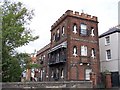
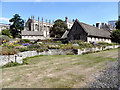
Photos of OX1 4NJ


Area Information
OX1 4NJ covers a small residential cluster with a total area of 6,044 square metres. This postcode encompasses a population of 1,203 residents, creating a compact and concentrated community. Living in OX1 4NJ means navigating a high-density environment where the population density reaches 199,042 people per square kilometre. Such a figure indicates that the housing stock is closely packed, offering convenience but limited garden space or private outdoor areas. The location sits primarily within Oxford, England, positioning residents close to the city centre while maintaining a distinct residential identity. This small footprint defines the daily rhythm of the area, where neighbours are often nearby and the local character is shaped by close proximity. For those considering homes in OX1 4NJ, the scale of the area suggests a sense of intimacy rather than sprawling suburbia. Every street contributes to a collective living experience where public spaces are shared and active. The area's specific postcode coverage ensures that all local services are within short walking distances. This clustering creates a self-contained environment ideal for those who prefer to be near their immediate surroundings. The density drives a unique way of life typical of central residential zones where community interaction is frequent.
- Area Type
- Postcode
- Area Size
- 6044 m²
- Population
- 1203
- Population Density
- 3949 people/km²
The property market in OX1 4NJ is defined by a shift toward rental living, with only 38% of homes owner-occupied. Flats represent the primary accommodation type, consistent with the high density found within the 6,044 square metre boundary. This housing stock suggests that many residents prioritise location over land ownership or extensive outdoor space. Buyers looking at homes in OX1 4NJ should expect a concentration of apartment units rather than detached houses or semi-detached properties. The low rate of home ownership implies that the area appeals strongly to professionals seeking access to Oxford city centre and transport links. While some residents own their property, the majority reside in rental accommodations. This dynamic creates a fluid market where tenancies may change hands more frequently than in owner-occupier dominated suburbs. The prevalence of flats also means that buyers must consider leasehold implications or shared ownership schemes depending on their search. For those willing to navigate the rental sector, the location offers immediate proximity to retail and rail. First-time buyers or investors might find value in the high-density model, though competition for available flats can be stiff. Understanding that three-quarters of the population rents provides context for the local economy and social interactions.
House Prices in OX1 4NJ
Showing 21 properties
Energy Efficiency in OX1 4NJ
Amenities near OX1 4NJ provide essential convenience for daily life. Five major retail outlets operate within practical reach, including Tesco Oxford, Sainsburys Oxford, and M&S Oxford. Residents can purchase groceries, clothing, and household essentials without leaving the immediate vicinity. Dining options are supported by the presence of these large supermarkets, which often host in-store cafes and restaurants. Three railway stations offer regular departures to key destinations such as Banbury, London, and Hampton. Oxford Parkway serves as the primary hub for long-distance travel, while Radley and Islip provide local connections. This blend of retail and rail infrastructure creates a self-sufficient lifestyle where essential errands take minimal time. You can stock up on shopping bags in the morning and catch a train by early afternoon. The proximity to these specific venues enhances the appeal of living in OX1 4NJ for busy commuters and shoppers alike. Families appreciate the ability to run errands quickly and return home promptly.
Amenities
Schools
Families with young children have several educational options near OX1 4NJ. Grandpont Nursery School serves the youngest residents in the cluster, offering early years education. St Ebbe's Church of England Aided Primary school holds a 'good' Ofsted rating, providing a recognised standard for younger students. This mix of nursery and primary institutions meets the needs of all pre-school age groups without requiring travel to distant campuses. The availability of a rated primary school supports families who wish to keep childcare local. While secondary education data is not listed in the immediate vicinity, the presence of Grandpont and St Ebbe's creates a seamless transition for early learning. These institutions are situated close enough that walking is a viable option for most households in OX1 4NJ. Local parents can access structured learning environments within the same postcode area. The inclusion of a Church of England primary school adds cultural variety to the educational landscape. Prospective homebuyers seeking schools in the OX1 4NJ zone will find these two key providers. The combination of a nursery and a good-rated primary school offers a comprehensive foundation for early childhood development.
| Rank | School | Type | Entry gender | Ages |
|---|
Explore more schools in this area
Go to Schools tabDemographics
The community in OX1 4NJ reflects a mature demographic profile with a median age of 47 years. Adults aged 30 to 64 years form the most common age range, indicating that the area attracts families and established professionals. Children under ten represent a smaller portion of the population compared to this working-age majority. Home ownership stands at 38%, meaning that a significant proportion of residents rent their accommodation. Flats constitute the predominant accommodation type, aligning with the high-density nature of the postcode. The resident population is predominantly White, reflecting the broader demographic makeup of Oxford. With 62% of homes rented, the area supports transient workers or tenants seeking central locations. This ownership split suggests a mix of long-term residents and newcomers drawn to the city amenities. The age distribution points to a stable population where decision-making power often rests with older adults. Families with school-age children coexist with empty nesters and dual-career households. This demographic balance influences local consumption patterns and community needs. Understanding these figures helps potential buyers gauge the neighbourhood's character and future trajectory. The data confirms a settled community with a clear focus on practical living arrangements.
Household Size
Accommodation Type
Tenure
Ethnic Group
Religion
Household Composition
Age
Household Deprivation
NS-SEC
Explore more demographic insights in this area
Go to Demographics tabPlanning
Planning Constraints
- Flood RiskPremium
- Ramsar Wetland SitesPremium
- Area of Outstanding Natural BeautyPremium
- Protected Nature ReservePremium
- Protected WoodlandPremium