Area Overview for OX1 1TN
Photos of OX1 1TN
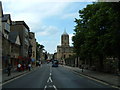

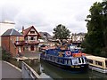
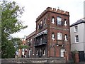

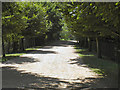
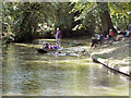
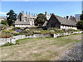
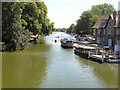
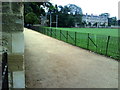

100 photos from this area
Area Information
Key information about the OX1 1TN including its size, population, and administrative classification.
- Area Type
- Postcode
- Area Size
- 5905 m²
- Population
- 1203
- Population Density
- 3949 people/km²
House Prices in OX1 1TN
29
Properties
£349,485
Average Sold Price
£103,000
Lowest Price
£502,000
Highest Price
Showing 29 properties
| Address | Type | Beds | Baths | Last Sale Price | Last Sale Date | |
|---|---|---|---|---|---|---|
| 10 Trinity Street, Oxford, OX1 1TN | house | - | - | £502,000 | Jul 2023 | |
| 18 Trinity Street, Oxford, OX1 1TN | Terraced | 3 | 1 | £452,000 | Oct 2022 | |
| 35 Trinity Street, Oxford, OX1 1TN | Terraced | 2 | 1 | £395,000 | Feb 2022 | |
| 5 Trinity Street, Oxford, OX1 1TN | house | - | - | £480,000 | Jan 2022 | |
| 13 Trinity Street, Oxford, OX1 1TN | Terraced | 2 | - | £388,000 | Mar 2021 | |
| 17 Trinity Street, Oxford, OX1 1TN | Terraced | 2 | 1 | £405,000 | Feb 2020 | |
| 15 Trinity Street, Oxford, OX1 1TN | house | 3 | 1 | £467,000 | Jun 2017 | |
| 11 Trinity Street, Oxford, OX1 1TN | house | 2 | - | £390,000 | Mar 2017 | |
| 7 Trinity Street, Oxford, OX1 1TN | Terraced | 2 | 2 | £450,000 | Feb 2017 | |
| 19 Trinity Street, Oxford, OX1 1TN | house | - | - | £349,700 | Jan 2016 |
Page 1 of 3
Energy Efficiency in OX1 1TN
Amenities
Schools
| Rank | School | Type | Entry gender | Ages |
|---|
Explore more schools in this area
Go to Schools tabDemographics
Household Size
One person
most common
Accommodation Type
Flats
most common
Tenure
38
majority
Ethnic Group
White
most common
Religion
N/A
most common
Household Composition
N/A
most common
Age
47
median
Adults (30-64 years)
most common
Household Deprivation
N/A
with no deprivation
NS-SEC
43
in Lower managerial occupations
Explore more demographic insights in this area
Go to Demographics tabPlanning
Planning Constraints
- Flood RiskPremium
- Ramsar Wetland SitesPremium
- Area of Outstanding Natural BeautyPremium
- Protected Nature ReservePremium
- Protected WoodlandPremium