Area Overview for OX1 4NH
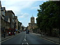
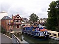
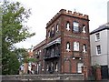
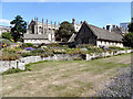
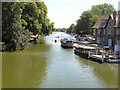
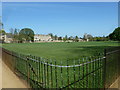
Photos of OX1 4NH


Area Information
OX1 4NH is a defined residential cluster covering 8,760 square metres within the broader city of Oxford. You are looking at a very compact living environment where 1,203 residents call this specific postcode their home. The population density stands at 137,322 people per square kilometre, indicating a highly concentrated settlement rather than sprawling suburbs. This postcode represents a specific slice of Oxford life, characterised by its small scale and high density. Living in OX1 4NH means integrating into a tight-knit residential unit where neighbours are in close proximity. The area functions as a distinct neighbourhood cluster rather than a standalone locality. Its size suggests a community where daily journeys are short and the perimeter is clearly defined. You will find this postcode situated within the functional boundaries of Oxford, benefiting from the city's established infrastructure while maintaining a contained footprint. The mix of urban density and specific postal boundaries creates a unique living context for homeowners and renters alike.
- Area Type
- Postcode
- Area Size
- 8760 m²
- Population
- 1203
- Population Density
- 3949 people/km²
Housing in OX1 4NH is defined by a rental-dominated market with a home ownership rate of 38 per cent. This figure indicates that nearly two-thirds of the 1,203 residents rent their properties. The accommodation type is overwhelmingly flats, which shapes the character of the built environment. You are not looking at a suburban area of semi-detached houses or large detached bungalows for this specific postcode. Instead, the inventory consists largely of vertically stacked living units suitable for urban living. This concentration of flats suggests a property market geared towards investors and tenants seeking flexible, city-centre style living within Oxford. If you are a first-time buyer or investor, the low ownership rate and flat-heavy stock present an interesting opportunity in a high-density zone. The sheer number of flats relative to owners creates a specific dynamic for both landlords and potential purchasers. You must consider the rental nature of the cluster when evaluating investment potential or suitability for long-term ownership.
House Prices in OX1 4NH
Showing 61 properties
Energy Efficiency in OX1 4NH
Residents of OX1 4NH enjoy immediate access to major retail chains and rail travel hubs. Within practical reach, you will find Tesco Oxford, Sainsburys Oxford, and M&S Oxford available for shopping needs. These three large retailers provide a comprehensive range of groceries and general goods without requiring a long journey into the city centre. For travel, three railway stations offer transport links: Oxford Parkway Railway Station, Radley Railway Station, and Islip Railway Station. These stations ensure you have multiple options for commuting or leisure travel. The concentration of amenities alongside rail access creates a convenient lifestyle focused on accessibility. You do not need to leave the broader Oxford area to access supermarkets or national rail networks. The nearby amenities support a pragmatic daily routine where shopping and travel are both efficient. This blend of retail and transport options defines the character of neighbourhood living here.
Amenities
Schools
Families looking at OX1 4NH have access to established educational institutions immediately on their doorstep. Grandpont Nursery School operates in the area, catering to the earliest years of learning. For primary education, St Ebbe's Church of England Aided Primary School stands nearby and holds a 'good' Ofsted rating. This specific rating confirms the school meets expected standards for education and care. The presence of a nursery and a rated primary school supports young children within OX1 4NH. The combination of these facilities means parents do not need to travel far for early education needs. Schools near OX1 4NH provide a manageable environment for families, with the primary school receiving official positive accreditation. The limited list of providers in this small cluster highlights a focused approach to local education. You can confidently point to St Ebbe's Church of England Aided Primary School as a verified educational option for children attending school in this postcode.
| Rank | School | Type | Entry gender | Ages |
|---|
Explore more schools in this area
Go to Schools tabDemographics
The community profile of OX1 4NH reflects a mature residential area with a median age of 47 years. Adults aged between 30 and 64 years form the most common age range, suggesting a demographic stabilised in mid-life rather than a zone of young families or students. Home ownership stands at 38 per cent, meaning the majority of residents rent their current accommodation. You will predominantly find flats within this postcode, which aligns with the demographic trend of adult residents rather than those seeking detached family homes. The predominant ethnic group is white, representing the makeup of the current population. This area is not characterised by deprivation figures in the provided data, allowing the focus to remain on established living patterns. The combination of a high median age, significant rental presence, and flat-based housing describes a settled urban environment. Prospective buyers should note that the housing stock caters primarily to adults and professionals who require flat-style living arrangements.
Household Size
Accommodation Type
Tenure
Ethnic Group
Religion
Household Composition
Age
Household Deprivation
NS-SEC
Explore more demographic insights in this area
Go to Demographics tabPlanning
Planning Constraints
- Flood RiskPremium
- Ramsar Wetland SitesPremium
- Area of Outstanding Natural BeautyPremium
- Protected Nature ReservePremium
- Protected WoodlandPremium