Area Overview for OX1 4LR
Photos of OX1 4LR
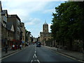

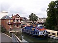
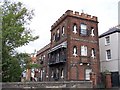
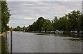
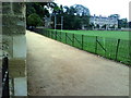
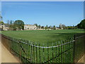
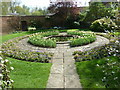
100 photos from this area
Area Information
Key information about the OX1 4LR including its size, population, and administrative classification.
- Area Type
- Postcode
- Area Size
- 6382 m²
- Population
- 1203
- Population Density
- 3949 people/km²
House Prices in OX1 4LR
21
Properties
£434,521
Average Sold Price
£67,250
Lowest Price
£865,000
Highest Price
Showing 21 properties
| Address | Type | Beds | Baths | Last Sale Price | Last Sale Date | |
|---|---|---|---|---|---|---|
| 72 Marlborough Road, Oxford, OX1 4LR | Terraced | 4 | 1 | £865,000 | Jul 2025 | |
| 66 Marlborough Road, Oxford, OX1 4LR | Retail | 5 | 2 | £740,000 | Apr 2022 | |
| 64 Marlborough Road, Oxford, OX1 4LR | house | - | - | £650,000 | Nov 2015 | |
| 60 Marlborough Road, Oxford, OX1 4LR | Terraced | 3 | - | £565,000 | Sep 2014 | |
| 52 Marlborough Road, Oxford, OX1 4LR | house | - | - | £488,000 | May 2011 | |
| 74 Marlborough Road, Oxford, OX1 4LR | house | - | - | £310,000 | Jul 2010 | |
| 56 Marlborough Road, Oxford, OX1 4LR | Terraced | - | - | £385,000 | Jul 2007 | |
| 48 Marlborough Road, Oxford, OX1 4LR | Terraced | - | - | £385,000 | Sep 2006 | |
| 58 Marlborough Road, Oxford, OX1 4LR | Terraced | 5 | 2 | £285,000 | Aug 2004 | |
| 76 Marlborough Road, Oxford, OX1 4LR | Terraced | 3 | 2 | £365,000 | Jul 2004 |
Page 1 of 3
Energy Efficiency in OX1 4LR
Amenities
Schools
| Rank | School | Type | Entry gender | Ages |
|---|
Explore more schools in this area
Go to Schools tabDemographics
Household Size
One person
most common
Accommodation Type
Flats
most common
Tenure
38
majority
Ethnic Group
White
most common
Religion
N/A
most common
Household Composition
N/A
most common
Age
47
median
Adults (30-64 years)
most common
Household Deprivation
N/A
with no deprivation
NS-SEC
43
in Lower managerial occupations
Explore more demographic insights in this area
Go to Demographics tabPlanning
Planning Constraints
- Flood RiskPremium
- Ramsar Wetland SitesPremium
- Area of Outstanding Natural BeautyPremium
- Protected Nature ReservePremium
- Protected WoodlandPremium