Area Overview for MK16 9PB
Photos of MK16 9PB
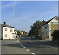
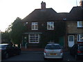
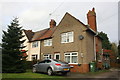
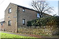
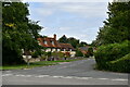
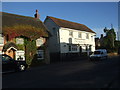

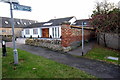
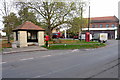
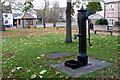
21 photos from this area
Area Information
Key information about the MK16 9PB including its size, population, and administrative classification.
- Area Type
- Postcode
- Area Size
- 1.4 hectares
- Population
- 1313
- Population Density
- 56 people/km²
House Prices in MK16 9PB
19
Properties
£390,450
Average Sold Price
£51,000
Lowest Price
£880,000
Highest Price
Showing 19 properties
| Address | Type | Beds | Baths | Last Sale Price | Last Sale Date | |
|---|---|---|---|---|---|---|
| 2 Church Road, Sherington, MK16 9PB | Cottage | 2 | 1 | £283,500 | Nov 2023 | |
| 6 Church Road, Sherington, MK16 9PB | Detached | 5 | - | £880,000 | Sep 2022 | |
| 24 Church Road, Sherington, MK16 9PB | Terraced | 3 | - | £255,000 | Jun 2021 | |
| 6A Church Road, Sherington, MK16 9PB | house | - | - | £570,000 | Nov 2020 | |
| 8A Church Road, Sherington, MK16 9PB | Bungalow | 5 | 3 | £515,000 | Oct 2018 | |
| Arbour Cottage, Church Road, Sherington, MK16 9PB | house | 2 | - | £450,000 | Aug 2016 | |
| 4 Church Road, Sherington, MK16 9PB | house | 2 | - | £265,000 | Apr 2012 | |
| Griggs Farmhouse, 22 Church Road, Sherington, MK16 9PB | Semi-detached | 4 | 3 | £550,000 | Aug 2006 | |
| 2A Church Road, Sherington, MK16 9PB | Detached | - | - | £51,000 | Jul 1997 | |
| 20 Church Road, Sherington, MK16 9PB | Semi-detached | - | - | £85,000 | Jul 1997 |
Page 1 of 2
Energy Efficiency in MK16 9PB
Amenities
Schools
| Rank | School | Type | Entry gender | Ages |
|---|
Explore more schools in this area
Go to Schools tabDemographics
Household Size
Two person
most common
Accommodation Type
Houses
most common
Tenure
74
majority
Ethnic Group
White
most common
Religion
N/A
most common
Household Composition
N/A
most common
Age
47
median
Adults (30-64 years)
most common
Household Deprivation
N/A
with no deprivation
NS-SEC
43
in Lower managerial occupations
Explore more demographic insights in this area
Go to Demographics tabPlanning
Planning Constraints
- Flood RiskPremium
- Ramsar Wetland SitesPremium
- Area of Outstanding Natural BeautyPremium
- Protected Nature ReservePremium
- Protected WoodlandPremium