Area Overview for MK16 9PA
Photos of MK16 9PA
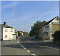
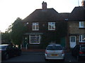
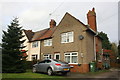
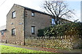

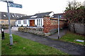
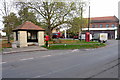
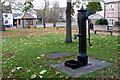
21 photos from this area
Area Information
Key information about the MK16 9PA including its size, population, and administrative classification.
- Area Type
- Postcode
- Area Size
- 3.7 hectares
- Population
- 1313
- Population Density
- 56 people/km²
House Prices in MK16 9PA
22
Properties
£372,500
Average Sold Price
£60,000
Lowest Price
£738,000
Highest Price
Showing 22 properties
| Address | Type | Beds | Baths | Last Sale Price | Last Sale Date | |
|---|---|---|---|---|---|---|
| 9 Church Road, Sherington, MK16 9PA | Semi-detached | 3 | 2 | £460,000 | Jun 2019 | |
| 1A Church Road, Sherington, MK16 9PA | Bungalow | - | - | £363,000 | Jan 2018 | |
| 27 Church Road, Sherington, MK16 9PA | Detached | 4 | 3 | £670,000 | Dec 2016 | |
| Sherington Place, Church Road, Sherington, MK16 9PA | Detached | 5 | 3 | £738,000 | Mar 2015 | |
| 37 Church Road, Sherington, MK16 9PA | Semi-detached | 3 | - | £314,000 | Feb 2014 | |
| 1 Church Road, Sherington, MK16 9PA | Detached | - | - | £415,000 | Nov 2007 | |
| 7 Church Road, Sherington, MK16 9PA | Semi-detached | - | - | £249,995 | Jul 2004 | |
| 35 Church Road, Sherington, MK16 9PA | Semi-detached | - | - | £235,000 | Jul 2003 | |
| 29 Church Road, Sherington, MK16 9PA | Detached | - | - | £220,000 | Apr 2002 | |
| 31 Church Road, Sherington, MK16 9PA | Semi-detached | - | - | £60,000 | May 1996 |
Page 1 of 3
Energy Efficiency in MK16 9PA
Amenities
Schools
| Rank | School | Type | Entry gender | Ages |
|---|
Explore more schools in this area
Go to Schools tabDemographics
Household Size
Two person
most common
Accommodation Type
Houses
most common
Tenure
74
majority
Ethnic Group
White
most common
Religion
N/A
most common
Household Composition
N/A
most common
Age
47
median
Adults (30-64 years)
most common
Household Deprivation
N/A
with no deprivation
NS-SEC
43
in Lower managerial occupations
Explore more demographic insights in this area
Go to Demographics tabPlanning
Planning Constraints
- Flood RiskPremium
- Ramsar Wetland SitesPremium
- Area of Outstanding Natural BeautyPremium
- Protected Nature ReservePremium
- Protected WoodlandPremium