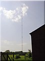
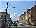
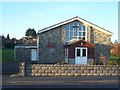
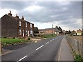
Area Overview for Medway (B)
Photos of Medway (B)


Area Information
Medway (B) is a local authority district covering 268.9 square kilometres, offering a distinct alternative to more urbanised locations in Kent and Greater London. This area functions as a comprehensive residential unit with a specific profile that appeals to buyers seeking space across a significant landmass. Living in Medway (B) often means dealing with a region where the character of daily life is shaped by its size and specific environmental constraints rather than a dense city centre. The district provides a broad canvas for different types of communities, yet it is notable for the substantial natural features that integrate into the local landscape. You should understand that this district includes areas designated as a high-value landscape, which influences development and views. The scale of Medway (B) allows for varied living environments, from developed towns to rural sectors. This area does not possess a single central hub but rather functions as a collection of neighbourhoods spread across nearly 269 square kilometres. For you, a potential homebuyer, this geography means that travel times to essential services may vary significantly depending on your chosen property. The district's identity is rooted in this physical spread, creating a lifestyle where the outdoors and natural constraints are immediate factors in your daily routine. Any decision to buy homes in Medway (B) requires an appreciation of this geography and the practical realities of moving through such a large administrative boundary.
- Area Type
- District/Borough
- Area Size
- 268.9 km²
- Population
- Not available
- Population Density
- Not available
Demographics
The community within Medway (B) presents a notably mature demographic profile compared to many other parts of England. The median age stands at 70, indicating that the population consists largely of retirees or older adults. This number defines the social atmosphere of the district, suggesting a quieter environment where community activities often cater to older generations. Understanding this figure is crucial for you if you are considering schools near Medway (B) or local leisure facilities, as the primary school population is likely small relative to the total headcount. Most common age ranges align with this high median, reinforcing the area's status as a retirement or semi-retirement destination. Home ownership is a dominant feature of life in Medway (B), with 66 per cent of residents owning their property outright or with a mortgage. This high ownership rate is typical of districts with older populations, where lifetime savings have facilitated property purchase rather than long-term renting. The household composition reflects this stability, though specific breakdowns of single-person versus family units are not detailed in the current figures. Accommodation types available within the district support this high ownership percentage, likely consisting of bungalows, terraced houses, and semi-detached properties favoured by this age group. You should expect a mature, stable neighbourhood with few transient populations. The ethnic and religious diversity of the area follows standard regional trends, but the primary defining characteristic is the age structure.
Household Size
Accommodation Type
Tenure
Ethnic Group
Religion
Household Composition
Age
Household Deprivation
NS-SEC
Explore more demographic insights in this area
Go to Demographics tabPlanning
Planning Constraints
- Flood RiskPremium
- Ramsar Wetland SitesPremium
- Area of Outstanding Natural BeautyPremium
- Protected WoodlandPremium