Area Overview for Gravesham District (B)
Photos of Gravesham District (B)


Area Information
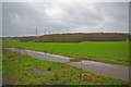
Gravesham District represents a distinctive administrative area in Kent, centred on the historic town of Gravesend. This local authority unit covers 105 square kilometres and unites the towns of Gravesend and Northfleet with surrounding villages such as Higham, Shorne, Cobham, and Meopham. The borough formed as a single administrative authority on 1 April 1974, merging previously separate rural districts. Living in Gravesham District means navigating a landscape that transformed from agricultural land with orchards and market gardens into a built-up environment featuring residential developments, factories, and chalk quarries. The area sits on the south bank of the River Thames and extends inland towards the North Downs chalk hills. Historical depth defines the character of places like Northfleet, which once exceeded Gravesend in size and now holds significant Roman heritage at the Springhead temple complex. You will find a mix of historic settlements and industrial areas where cement production and shipbuilding shaped the local economy. This district offers a blend of riverine history and inland geography that defines daily life for its residents.
- Area Type
- District/Borough
- Area Size
- 105.0 km²
- Population
- Not available
- Population Density
- Not available
Demographics
The community within Gravesham District reflects an older population structure with a median age of 70 years. This age profile suggests the area attracts retirees or families with grown children rather than young adults entering the workforce. Household composition data indicates a dominance of total household types, though specific breakdowns for couples or families are not disclosed in the available records. Home ownership stands at 63%, a figure that places Gravesham District solidly in owner-occupied territory. This high level of ownership suggests many residents have lived in their homes for extended periods, contributing to stable neighbourhoods. The borough does not publish specific statistics on household composition or predominant ethnic groups, so you cannot determine the exact diversity of the population from current records. Similarly, religious affiliation data is not provided, preventing any analysis of spiritual community cohesion. Despite the lack of granular demographic details, the high home ownership rate confirms that this remains a settled residential area where long-term residents dominate the housing stock.
Household Size
Accommodation Type
Tenure
Ethnic Group
Religion
Household Composition
Age
Household Deprivation
NS-SEC
Explore more demographic insights in this area
Go to Demographics tabPlanning
Planning Constraints
- Flood RiskPremium
- Ramsar Wetland SitesPremium
- Area of Outstanding Natural BeautyPremium
- Protected Nature ReservePremium
- Protected WoodlandPremium