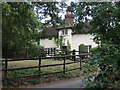
Area Overview for ME9 7XE
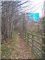
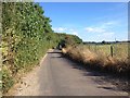
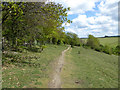
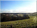
Photos of ME9 7XE


Area Information
ME9 7XE is a small, tightly knit residential area in England, covering 55.1 hectares and home to 1,872 residents. Its compact size fosters a quiet, community-focused atmosphere, with a population density of 191 people per square kilometre. The area is predominantly occupied by adults aged 30–64, with a median age of 47, reflecting a mature, stable demographic. Most properties are owner-occupied homes, and the area enjoys low crime risk, scoring 69 on a 100-point safety scale. While it lies within an Area of Outstanding Natural Beauty (AONB), this designation does not impede daily life but adds a layer of environmental significance. Nearby, residents have access to essential amenities, including primary schools, rail stations, and retail hubs. The presence of protected woodland and proximity to nature reserves suggest a balance between urban convenience and natural surroundings. For those seeking a peaceful, family-oriented environment with practical connectivity, ME9 7XE offers a blend of safety, accessibility, and a distinct local character.
- Area Type
- Postcode
- Area Size
- 55.1 hectares
- Population
- 1872
- Population Density
- 191 people/km²
ME9 7XE is primarily an owner-occupied area, with 73% of properties owned by residents rather than rented out. The housing stock is dominated by houses, which suggests a focus on family homes and traditional living arrangements. This contrasts with areas where flats or apartments predominate, and it may appeal to buyers seeking more space and privacy. Given the area’s small size, the property market is likely limited to a few key locations, with limited scope for expansion or new developments. The presence of protected woodland and an AONB designation could influence planning permissions, potentially restricting alterations or new builds. For buyers, this means the available housing is likely to be in established homes, with limited turnover. The emphasis on owner-occupation also suggests a long-term investment focus, with residents prioritising stability over rental yields.
House Prices in ME9 7XE
Showing 12 properties
| Address | Type | Beds | Baths | Last Sale Price | Last Sale Date | |
|---|---|---|---|---|---|---|
| 1, Oak Barn Cottages, Yaugher Lane, Hartlip, ME9 7XE | Semi-detached | 3 | - | £445,000 | Nov 2016 | |
| 2, Oak Barn Cottages, Yaugher Lane, Hartlip, ME9 7XE | house | - | - | £250,000 | Mar 2010 | |
| Windmill Farm, Yaugher Lane, Hartlip, ME9 7XE | Land | 3 | 1 | - | - | |
| Laurentic Lodge, East Field, Yaugher Lane, Hartlip, ME9 7XE | Detached | - | - | - | - | |
| Shady Lane Lodge, Yaugher Lane, Hartlip, ME9 7XE | Detached | - | - | - | - | |
| Valley Alpacas, Alpaca Farm, Yaugher Lane, Hartlip, ME9 7XE | Farm | - | - | - | - | |
| Weddings In Kent, Wedding Venue, Alpaca Farm, Yaugher Lane, Hartlip, ME9 7XE | commercial | - | - | - | - | |
| The Stables, Alpaca Farm, Yaugher Lane, Hartlip, ME9 7XE | Mobile Home | - | - | - | - | |
| Little Place Farm, Yaugher Lane, Hartlip, ME9 7XE | Farm | - | - | - | - | |
| Oak Barn Farm, Yaugher Lane, Hartlip, ME9 7XE | Detached | - | - | - | - |
Energy Efficiency in ME9 7XE
ME9 7XE’s lifestyle is shaped by its proximity to essential amenities, including five retail venues such as M&S Medway, Co-op Rainham, and Morrisons Daily. These shops provide convenience for everyday shopping, while the nearby rail stations offer access to broader regional services. The presence of Rochester Airport adds to the area’s connectivity, though it is not a major hub. The character of the area is defined by its small-scale offerings, where residents can find a mix of local stores and essential services without needing to travel far. The AONB designation and protected woodland may limit large-scale developments, preserving a natural feel. While the area lacks expansive parks or leisure facilities, its compact design ensures that amenities are within practical reach, supporting a low-maintenance lifestyle.
Amenities
Schools
The nearest school to ME9 7XE is Hartlip Endowed Church of England Primary School, which serves the local community with a primary education offering. Its Ofsted rating of ‘good’ indicates a reliable standard of teaching and facilities. While no secondary schools are listed in the data, the primary school’s proximity ensures that families with young children have immediate access to education. The absence of secondary school options may require students to commute to nearby towns, but the school’s performance suggests it provides a solid foundation for early learning. For parents prioritising strong primary education, this school is a key asset. However, the lack of data on secondary provision means buyers should investigate further if secondary schooling is a critical factor in their decision.
| Rank | School | Type | Entry gender | Ages |
|---|
Explore more schools in this area
Go to Schools tabDemographics
The community in ME9 7XE is defined by its mature population, with a median age of 47 and the majority of residents aged 30–64. This suggests a settled, long-term demographic, with 73% of households owning their homes. The area is predominantly composed of houses, reflecting a preference for traditional residential properties over flats or apartments. The predominant ethnic group is White, which aligns with broader trends in the region. While no specific data on deprivation is provided, the high home ownership rate and low crime score imply a relatively stable quality of life. The absence of significant diversity metrics in the data means the community’s social composition is largely homogenous. For buyers, this profile indicates a neighbourhood where families and professionals may find a sense of continuity and security, though it may lack the cultural diversity seen in more cosmopolitan areas.
Household Size
Accommodation Type
Tenure
Ethnic Group
Religion
Household Composition
Age
Household Deprivation
NS-SEC
Explore more demographic insights in this area
Go to Demographics tabPlanning
Planning Constraints
- Flood RiskPremium
- Ramsar Wetland SitesPremium
- Area of Outstanding Natural BeautyPremium
- Protected Nature ReservePremium
- Protected WoodlandPremium