Area Overview for ME9 7UP
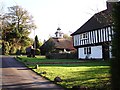
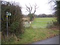
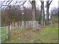
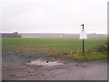
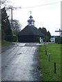
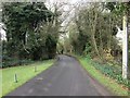
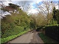
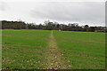
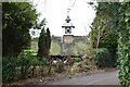
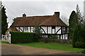
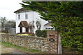
Photos of ME9 7UP

Area Information
ME9 7UP is a small, residential postcode area in England, covering 1.2 km² with a population of 2677 people. Its low population density of 41 people per square kilometre suggests a quiet, spacious living environment, typical of smaller rural or semi-rural clusters. The area is characterised by a mature community, with a median age of 47 and a majority of residents aged 30–64. This demographic profile indicates a stable, established population, often drawn to the area for its natural surroundings and proximity to essential services. While the postcode is not densely populated, it offers access to nearby amenities such as retail stores, rail stations, and a primary school. The presence of protected natural areas, including an Area of Outstanding Natural Beauty, adds to the landscape’s appeal, though it may influence local planning constraints. For those seeking a balance between tranquillity and accessibility, ME9 7UP provides a compact base with connections to larger towns and transport networks.
- Area Type
- Postcode
- Area Size
- 1.2 km²
- Population
- 2677
- Population Density
- 41 people/km²
The property market in ME9 7UP is largely owner-occupied, with 77% of homes owned by their residents. This high rate of home ownership indicates a stable, long-term demographic with little turnover. The accommodation type is predominantly houses, which is unusual for areas with higher density but aligns with the low population density of 41 people per square kilometre. This suggests a focus on single-family homes rather than flats or apartments, which may appeal to those prioritising space and privacy. Given the area’s small size, the housing stock is limited, and buyers should consider proximity to nearby towns for additional options. The presence of protected natural areas may influence development restrictions, but the overall market remains characterised by established properties in a low-density, residential setting.
House Prices in ME9 7UP
Showing 16 properties
| Address | Type | Beds | Baths | Last Sale Price | Last Sale Date | |
|---|---|---|---|---|---|---|
| Little Hill Green Farmhouse, Hill Green Road, Stockbury, ME9 7UP | Detached | - | - | £163,500 | Sep 1995 | |
| Pelistry, Hill Green Road, Stockbury, ME9 7UP | Detached | 6 | 3 | - | - | |
| The Barn Hill Green Farm, Hill Green Road, Stockbury, ME9 7UP | Mobile Home | - | - | - | - | |
| Annexe, Daynall, Hill Green Road, Stockbury, ME9 7UP | Flat | - | - | - | - | |
| The Pelistry Annexe, Hill Green Road, Stockbury, ME9 7UP | Detached | - | - | - | - | |
| Hill Tops, Hill Green Road, Stockbury, ME9 7UP | Detached | - | - | - | - | |
| Tismart, Green Acre Farm, Hill Green Road, Stockbury, ME9 7UP | Detached | - | - | - | - | |
| Caravan, Hill Green Farmhouse, Hill Green Road, Stockbury, ME9 7UP | Mobile Home | - | - | - | - | |
| Hill Green Farmhouse, Hill Green Road, Stockbury, ME9 7UP | Detached | - | - | - | - | |
| Daynall, Hill Green Road, Stockbury, ME9 7UP | Detached | - | - | - | - |
Energy Efficiency in ME9 7UP
The lifestyle in ME9 7UP is supported by nearby amenities, including five retail outlets such as M&S Medway, Co-op Rainham, and Morrisons Daily, offering essential shopping and dining options. The area’s rail stations provide access to broader networks, while Rochester Airport is within reach for regional travel. These amenities contribute to a convenient, self-contained lifestyle, though the low population density means services are not overly concentrated. The presence of protected natural areas, including woodlands and nature reserves, suggests opportunities for outdoor activities, though specific parks or recreational spaces are not detailed in the data. Overall, the area balances practicality with a connection to the surrounding countryside.
Amenities
Schools
The nearest school to ME9 7UP is Hollingbourne Primary School, which provides education for younger children and holds a good Ofsted rating. This school is a key consideration for families with children, though no secondary schools are listed in the data. The availability of a primary school within reach supports the area’s appeal to families, though parents may need to look further afield for secondary education. The presence of a rated primary school suggests a commitment to local education, but the lack of secondary options may influence decisions for larger families or those requiring comprehensive schooling.
| Rank | School | Type | Entry gender | Ages |
|---|
Explore more schools in this area
Go to Schools tabDemographics
The community in ME9 7UP is predominantly composed of adults aged 30–64, with a median age of 47. This suggests a population that is largely in middle age or beyond, reflecting a settled, long-term resident base. Home ownership is high, with 77% of households owning their properties, indicating a strong sense of local permanence. The accommodation type is primarily houses, which aligns with the area’s lower density and more spacious living conditions. The predominant ethnic group is White, though no further breakdown of diversity is provided in the data. The population density of 41 people per square kilometre is notably low, which may contribute to a quieter, less congested environment. This demographic profile suggests a community focused on stability and family-oriented living, with limited reliance on rental housing.
Household Size
Accommodation Type
Tenure
Ethnic Group
Religion
Household Composition
Age
Household Deprivation
NS-SEC
Explore more demographic insights in this area
Go to Demographics tabPlanning
Planning Constraints
- Flood RiskPremium
- Ramsar Wetland SitesPremium
- Area of Outstanding Natural BeautyPremium
- Protected Nature ReservePremium
- Protected WoodlandPremium