Area Overview for ME9 7SQ
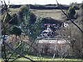
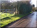
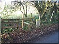
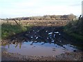
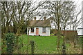
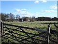
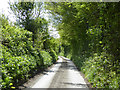
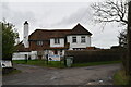
Photos of ME9 7SQ
Area Information
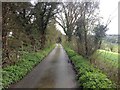
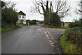
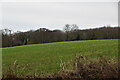
ME9 7SQ is a small, tightly knit residential area in England, covering 18.2 hectares and home to 2,677 residents. With a population density of 41 people per square kilometre, it balances quiet living with accessible amenities. The area’s compact size means most daily needs are within walking or short driving distance, fostering a sense of community. The median age of 47 suggests a stable, mature demographic, with adults aged 30–64 forming the largest group. This is a place where homeownership is strong—77% of residents own their homes—reflecting a preference for long-term settlement. The area’s character is defined by its mix of local shops, transport links, and nearby natural spaces, offering a blend of convenience and tranquillity. While not a bustling urban hub, ME9 7SQ provides a practical base for families and professionals, with schools, rail stations, and retail options nearby. Its low flood risk and proximity to protected landscapes, such as the Area of Outstanding Natural Beauty, add to its appeal for those seeking a balance between rural and suburban living.
- Area Type
- Postcode
- Area Size
- 18.2 hectares
- Population
- 2677
- Population Density
- 41 people/km²
ME9 7SQ is a predominantly owner-occupied area, with 77% of residents living in their own homes. This high rate of homeownership suggests a community of long-term residents rather than a rental market. The accommodation type is primarily houses, which is unusual for a small postcode area but aligns with the lower population density of 41 people per square kilometre. This means properties are likely to be larger and more spread out than in densely populated urban zones. For buyers, this implies a focus on individual homes rather than flats or shared housing. The area’s compact size means the housing stock is limited, so buyers should consider nearby areas for more options. The mix of houses and moderate population density suggests a balance between privacy and accessibility, making it attractive to families and professionals seeking a quieter alternative to larger towns.
House Prices in ME9 7SQ
Showing 17 properties
| Address | Type | Beds | Baths | Last Sale Price | Last Sale Date | |
|---|---|---|---|---|---|---|
| Four Oaks, West Wood Road, Stockbury, ME9 7SQ | Detached | 4 | 2 | £461,500 | Apr 2007 | |
| Caravan 2, 4A West Wood Road, Stockbury, ME9 7SQ | Mobile Home | - | - | - | - | |
| Caravan 2, 6 West Wood Road, Stockbury, ME9 7SQ | Detached | - | - | - | - | |
| Caravan 2, 5 West Wood Road, Stockbury, ME9 7SQ | Mobile Home | - | - | - | - | |
| 6 West Wood Road, Stockbury, ME9 7SQ | Mobile Home | - | - | - | - | |
| Caravan 3, 6 West Wood Road, Stockbury, ME9 7SQ | Mobile Home | - | - | - | - | |
| Cherry Tree Stables, West Wood Road, Stockbury, ME9 7SQ | Mobile Home | - | - | - | - | |
| 4B West Wood Road, Stockbury, ME9 7SQ | Detached | - | - | - | - | |
| Mobile Home, Evergreen, West Wood Road, Stockbury, ME9 7SQ | Mobile Home | - | - | - | - | |
| 4C West Wood Road, Stockbury, ME9 7SQ | Detached | - | - | - | - |
Energy Efficiency in ME9 7SQ
Residents of ME9 7SQ have access to a range of local amenities within practical reach. The retail sector includes M&S Medway, Co-op Rainham, and Morrisons Daily, offering everyday shopping needs. Rail stations provide easy access to nearby towns, while Rochester Airport adds to the area’s connectivity. For leisure, the proximity to the Area of Outstanding Natural Beauty offers opportunities for outdoor activities, though the protected woodland within the area may limit certain developments. The combination of local shops, transport links, and natural spaces creates a lifestyle that balances convenience with a quieter, more scenic environment. While the broadband score is low, the mobile coverage and rail access compensate for this, making the area suitable for those prioritising accessibility over high-speed internet.
Amenities
Schools
The nearest school to ME9 7SQ is Hollingbourne Primary School, which serves the local community with a primary education offering. Its Ofsted rating of ‘good’ indicates a satisfactory standard of teaching and facilities. While no secondary schools are listed in the data, the presence of a primary school suggests that families with younger children can access essential education locally. The absence of secondary schools may require students to travel to nearby towns for further education, but the proximity of rail stations like Newington and Rainham makes this feasible. The school’s rating reflects a stable educational environment, though parents should consider the broader school network in the surrounding area when planning for long-term needs.
| Rank | School | Type | Entry gender | Ages |
|---|
Explore more schools in this area
Go to Schools tabDemographics
The community in ME9 7SQ is predominantly composed of adults aged 30–64, with a median age of 47. This suggests a population focused on established careers and family life, rather than younger professionals or retirees. Homeownership is high, at 77%, indicating a stable residential base with fewer renters. The accommodation type is primarily houses, which aligns with the area’s lower population density and more spacious living arrangements. The predominant ethnic group is White, reflecting the broader demographic trends of the region. While specific data on deprivation is not provided, the high home ownership rate and moderate population density suggest a community with relatively stable economic conditions. However, the presence of a medium crime risk score (60/100) implies that residents should remain vigilant about standard security measures. The area’s characteristics make it suitable for those prioritising long-term residency over transient living.
Household Size
Accommodation Type
Tenure
Ethnic Group
Religion
Household Composition
Age
Household Deprivation
NS-SEC
Explore more demographic insights in this area
Go to Demographics tabPlanning
Planning Constraints
- Flood RiskPremium
- Ramsar Wetland SitesPremium
- Area of Outstanding Natural BeautyPremium
- Protected Nature ReservePremium
- Protected WoodlandPremium