Area Overview for ME9 7UA
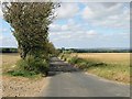
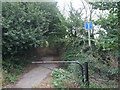
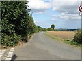
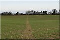
Photos of ME9 7UA


Area Information
ME9 7UA is a small, tightly knit residential area in England, covering 31.6 hectares and home to 2,677 residents. With a population density of 41 people per square kilometre, it strikes a balance between privacy and community access. The area is characterised by a mature demographic, with a median age of 47 and a majority of residents aged 30–64. This suggests a stable, long-term community with a focus on family living. The area’s compact size means amenities are within practical reach, while its location likely offers a blend of suburban comfort and proximity to larger towns. The presence of houses rather than flats indicates a preference for private, space-oriented living. For those seeking a quiet, established neighbourhood with a clear sense of place, ME9 7UA offers a distinct alternative to more densely populated zones. Its small footprint means residents are likely to know their neighbours, and the area’s low flood risk adds to its appeal as a safe, long-term investment.
- Area Type
- Postcode
- Area Size
- 31.6 hectares
- Population
- 2677
- Population Density
- 41 people/km²
ME9 7UA is primarily an owner-occupied area, with 77% of properties in private hands. The housing stock is almost entirely composed of houses, which is unusual for smaller postcode areas and suggests a focus on family homes rather than flats or apartments. This makes the area attractive to buyers seeking space and privacy, though the small size of the postcode means the housing market is limited in scale. The high proportion of owner-occupied properties indicates a stable market with fewer rental properties, which may appeal to those looking to build equity. However, the compact nature of the area means buyers should consider the immediate surroundings for additional options. The presence of houses also implies that the area is likely to cater to larger households, with potential for gardens or outdoor space. For those prioritising long-term ownership in a low-density, family-friendly setting, ME9 7UA offers a clear proposition.
House Prices in ME9 7UA
Showing 6 properties
| Address | Type | Beds | Baths | Last Sale Price | Last Sale Date | |
|---|---|---|---|---|---|---|
| 1, The Courtyard Cowstead Farm, Cowstead Road, Stockbury, ME9 7UA | Equestrian | 4 | 4 | - | - | |
| The Bungalow, Cowstead Farm, Cowstead Road, Stockbury, ME9 7UA | Bungalow | 4 | 1 | - | - | |
| 2, Old Wall Cottage, The Courtyard Cowstead Farm, Cowstead Road, Stockbury, ME9 7UA | Detached | - | - | - | - | |
| The Granary, Cowstead Farm, Cowstead Road, Stockbury, ME9 7UA | Detached | - | - | - | - | |
| Cowstead Farmhouse, Cowstead Road, Stockbury, ME9 7UA | Bungalow | - | - | - | - | |
| The Old Stables 3 The Courtyard, Cowstead Farm, Cowstead Road, Stockbury, ME9 7UA | Semi-detached | - | - | - | - |
Energy Efficiency in ME9 7UA
ME9 7UA offers a selection of retail and dining options within reach, including M&S Medway, Asda Rainham High, and Co-op Rainham. These stores provide essential shopping and grocery needs, reducing the need for long trips to larger centres. The area’s rail stations also connect residents to broader leisure opportunities, such as cultural attractions or outdoor spaces in nearby towns. While no parks or recreational facilities are explicitly listed, the proximity to rail links and the AONB designation suggest natural landscapes are accessible nearby. The combination of local shops, transport links, and potential for outdoor activities creates a lifestyle that balances convenience with the opportunity to explore beyond the immediate area.
Amenities
Schools
The nearest school to ME9 7UA is Hollingbourne Primary School, which serves the local community with a good Ofsted rating. As a primary school, it caters to children aged 4–11, providing a foundation for early education. The absence of secondary schools in the data means families may need to look further afield for secondary education, though the primary school’s rating suggests a reliable start to a child’s academic journey. The presence of a well-rated primary school is a key consideration for families, as it reduces the need for long commutes and supports a cohesive local community. With no other schools listed, the area’s educational provision is focused on early years, which may influence decisions about proximity to secondary schooling.
| Rank | School | Type | Entry gender | Ages |
|---|
Explore more schools in this area
Go to Schools tabDemographics
The population of ME9 7UA is predominantly adults aged 30–64, making up the most common age range. With a median age of 47, the community is older than the national average, suggesting a settled, family-oriented demographic. Home ownership is high, at 77%, reflecting a preference for long-term residency over renting. The area is largely composed of houses, which aligns with the age profile and likely supports larger households. The predominant ethnic group is White, and no specific data on deprivation or diversity is provided, though the high home ownership rate implies a relatively stable economic profile. The low population density of 41 people per square kilometre means residents enjoy greater personal space compared to urban areas. This combination of age, ownership, and housing type paints a picture of a community focused on stability, with residents likely prioritising security and long-term value over transient living.
Household Size
Accommodation Type
Tenure
Ethnic Group
Religion
Household Composition
Age
Household Deprivation
NS-SEC
Explore more demographic insights in this area
Go to Demographics tabPlanning
Planning Constraints
- Flood RiskPremium
- Ramsar Wetland SitesPremium
- Area of Outstanding Natural BeautyPremium
- Protected Nature ReservePremium
- Protected WoodlandPremium