Area Overview for ME9 7PT
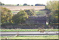
Photos of ME9 7PT


Area Information
ME9 7PT is a compact residential postcode area in England, covering just 9.2 hectares and home to 2,599 residents. Its small size means it is a tightly knit community, with a population density of 362 people per square kilometre. This area is characterised by its mix of older and newer housing stock, predominantly owner-occupied homes. The demographic profile suggests a mature population, with a median age of 47 and a majority of residents aged between 30 and 64. Living here offers proximity to essential services, including retail outlets and rail connections, while the low crime risk and minimal environmental constraints make it an attractive option for families and professionals seeking stability. The area’s modest size means it is well-suited to those prioritising convenience and a slower pace of life, with easy access to nearby towns and amenities.
- Area Type
- Postcode
- Area Size
- 9.2 hectares
- Population
- 2599
- Population Density
- 362 people/km²
The property market in ME9 7PT is dominated by owner-occupied homes, with 80% of properties owned by residents rather than rented. The area’s housing stock is largely composed of houses, which is typical for smaller residential clusters. This suggests a market where long-term residency is common, with fewer speculative investment properties. The limited area size means the housing stock is finite, so buyers should consider proximity to nearby towns for additional options. The predominance of owner-occupied homes indicates a community with established roots, where property values may reflect local demand for stable, family-friendly environments. For buyers, this means a focus on existing homes rather than new developments, with potential for value retention in a low-risk area.
House Prices in ME9 7PT
Showing 12 properties
| Address | Type | Beds | Baths | Last Sale Price | Last Sale Date | |
|---|---|---|---|---|---|---|
| 2, Danaway Cottages, Maidstone Road, Borden, ME9 7PT | Terraced | 1 | 1 | £215,000 | Jun 2025 | |
| Broomwood Lodge, Maidstone Road, Borden, ME9 7PT | Bungalow | 3 | 4 | £650,000 | Oct 2019 | |
| 4, Danaway Cottages, Maidstone Road, Borden, ME9 7PT | Terraced | 5 | 3 | £185,000 | Oct 2018 | |
| Broomwood Cottage, Maidstone Road, Borden, ME9 7PT | Detached | - | - | £150,000 | Jan 2007 | |
| 3, Danaway Cottages, Maidstone Road, Borden, ME9 7PT | Detached | 5 | 2 | £114,200 | May 2006 | |
| 6, Danaway Cottages, Maidstone Road, Borden, ME9 7PT | Terraced | 2 | - | £100,000 | Jan 2003 | |
| 7, Danaway Cottages, Maidstone Road, Borden, ME9 7PT | Terraced | 3 | - | £62,000 | Apr 2001 | |
| 1, Danaway Cottages, Maidstone Road, Borden, ME9 7PT | Terraced | 3 | 2 | - | - | |
| 5, Danaway Cottages, Maidstone Road, Borden, ME9 7PT | Terraced | 3 | - | - | - | |
| 9, Danaway Cottages, Maidstone Road, Borden, ME9 7PT | Terraced | 2 | - | - | - |
Energy Efficiency in ME9 7PT
Residents of ME9 7PT have access to a range of amenities within practical reach. The area is served by five rail stations, including Newington and Sittingbourne, facilitating travel to nearby towns and cities. Retail options include Asda Sittingbourne, Co-op Grove, and Budgens MRH, providing essential shopping and services. While the area itself is small, its proximity to larger centres means residents can enjoy a broader selection of leisure and dining options. The presence of rail links and retail hubs contributes to a convenient lifestyle, balancing local convenience with regional connectivity. The area’s modest size ensures a sense of community, with amenities designed to meet daily needs without the need for long commutes.
Amenities
Schools
The nearest school to ME9 7PT is Borden Church of England Primary School, which has an Ofsted rating of outstanding. This school is the primary educational institution for the area, serving young families within the postcode. The presence of a primary school with a top rating is a significant draw for households with children, offering high-quality early education. The absence of secondary schools in the immediate vicinity means families may need to look to nearby towns for further education, but the primary school’s excellence mitigates this concern. The school’s rating reflects strong teaching standards and student outcomes, reinforcing the area’s appeal to families prioritising education.
| Rank | School | Type | Entry gender | Ages |
|---|
Explore more schools in this area
Go to Schools tabDemographics
The community in ME9 7PT is predominantly middle-aged, with a median age of 47 and 80% of residents owning their homes. The majority of the population falls within the 30–64 age range, suggesting a stable, established demographic. Accommodation is primarily houses, reflecting a traditional housing stock. The predominant ethnic group is White, which aligns with broader regional trends. With 80% home ownership, the area shows strong residential continuity, indicating long-term occupancy rather than transient rental populations. The population density of 362 people per square kilometre is moderate, balancing residential comfort with community interaction. This profile suggests a neighbourhood where families and professionals coexist, with a focus on stability and local amenities.
Household Size
Accommodation Type
Tenure
Ethnic Group
Religion
Household Composition
Age
Household Deprivation
NS-SEC
Explore more demographic insights in this area
Go to Demographics tabPlanning
Planning Constraints
- Flood RiskPremium
- Ramsar Wetland SitesPremium
- Area of Outstanding Natural BeautyPremium
- Protected Nature ReservePremium
- Protected WoodlandPremium