Area Overview for ME9 7PX
Photos of ME9 7PX


Area Information
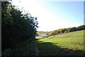
ME9 7PX is a small, compact postcode area in England, covering 95.8 hectares and home to 1,872 residents. Its modest size means it is a tight-knit residential cluster, with a population density of 191 people per square kilometre. This area is characterised by a mature demographic, with a median age of 47 and the majority of residents falling within the 30-64 age range. The community is predominantly home-owning, with 73% of properties owned by residents, and housing is largely composed of traditional houses rather than flats or apartments. Living here offers a quiet, low-density environment, with easy access to nearby towns via rail links. The area’s small footprint means it is not densely built, allowing for a sense of space and privacy. While it lacks major urban amenities, its proximity to rail stations and retail hubs in nearby towns ensures practical connectivity. For those seeking a settled, family-oriented environment with a focus on stability, ME9 7PX provides a straightforward, unpretentious lifestyle.
- Area Type
- Postcode
- Area Size
- 95.8 hectares
- Population
- 1872
- Population Density
- 191 people/km²
The property market in ME9 7PX is defined by high home ownership (73%) and a focus on traditional houses rather than flats or apartments. This suggests a community of long-term residents, many of whom have purchased their homes rather than rented. The small area size—just 95.8 hectares—means the housing stock is limited, with properties likely concentrated in a compact cluster. Buyers should expect a mix of family homes, given the area’s median age and the prevalence of houses. The lack of rental properties indicates a market primarily serving owner-occupiers, which could mean limited availability for renters. However, the proximity to rail stations and nearby towns like Sittingbourne may provide access to broader housing options. For buyers, the area’s small size and mature demographic mean properties are likely to be in established, low-maintenance condition, though the limited inventory may require a flexible approach to location.
House Prices in ME9 7PX
Showing 9 properties
| Address | Type | Beds | Baths | Last Sale Price | Last Sale Date | |
|---|---|---|---|---|---|---|
| Caravan 1, Wormdale Farm, Wormdale Hill, Newington, ME9 7PX | Mobile Home | - | - | - | - | |
| No Organisation Name, The Old Cattle Yard, Wormdale Farm, Wormdale Hill, Newington, ME9 7PX | warehouse | - | - | - | - | |
| Tebay Caravan, Wormdale Farm, Wormdale Hill, Newington, ME9 7PX | Mobile Home | - | - | - | - | |
| 2, Wormdale Farm Cottages, Wormdale Hill, Newington, ME9 7PX | house | - | - | - | - | |
| 1, Wormdale Farm Cottages, Wormdale Hill, Newington, ME9 7PX | house | - | - | - | - | |
| Oast House, Wormdale Hill, Newington, ME9 7PX | Detached | 3 | 1 | - | - | |
| The Stewards House, Wormdale Hill, Newington, ME9 7PX | Detached | - | - | - | - | |
| Flat Above, 47 Bayford Road, Sittingbourne, ME9 7PX | Flat | - | - | - | - | |
| Wormdale Farm, Wormdale Hill, Newington, ME9 7PX | house | - | - | - | - |
Energy Efficiency in ME9 7PX
Residents of ME9 7PX have access to nearby retail outlets such as Asda Sittingbourne, Co-op Grove, and Budgens MRH, providing essential shopping and services. The area’s rail stations, including Newington and Sittingbourne, offer easy access to larger towns for dining, leisure, and other amenities. While the data does not specify parks or recreational facilities, the proximity to rail networks suggests opportunities for weekend outings or commuting to cultural hubs. The lifestyle here is practical and low-key, with a focus on local essentials and connectivity to nearby towns. The absence of detailed information on parks or leisure venues means residents may need to travel for more extensive recreational activities, but the existing amenities support a straightforward, community-oriented daily life.
Amenities
Schools
The nearest school to ME9 7PX is Hartlip Endowed Church of England Primary School, which provides education for young children and holds a ‘good’ Ofsted rating. This school is the only one listed in the data, meaning families with children will need to consider commuting to nearby towns for secondary education. The presence of a primary school with a positive rating is a key factor for families prioritising early education. However, the absence of secondary schools or further education institutions within the area means parents should plan for travel to larger centres. The single school in the data highlights the area’s limited educational infrastructure, which may be a consideration for those requiring a full range of school options.
| Rank | School | Type | Entry gender | Ages |
|---|
Explore more schools in this area
Go to Schools tabDemographics
The population of ME9 7PX is 1,872, with a median age of 47, indicating a mature community. The majority of residents are adults aged 30-64, reflecting a demographic skewed towards middle-aged individuals. Home ownership is high at 73%, suggesting a stable, long-term resident base. The area is predominantly composed of houses, with no flats or apartments listed in the data. The predominant ethnic group is White, with no specific data provided on other groups. The population density of 191 people per square kilometre is moderate, balancing residential space with community interaction. This age profile and ownership pattern suggest a community focused on family living and long-term investment. The absence of detailed diversity statistics means the area’s cultural composition remains largely unexplored in the data, but the figures provided confirm a settled, middle-aged population with a strong emphasis on home ownership.
Household Size
Accommodation Type
Tenure
Ethnic Group
Religion
Household Composition
Age
Household Deprivation
NS-SEC
Explore more demographic insights in this area
Go to Demographics tabPlanning
Planning Constraints
- Flood RiskPremium
- Ramsar Wetland SitesPremium
- Area of Outstanding Natural BeautyPremium
- Protected Nature ReservePremium
- Protected WoodlandPremium