Area Overview for ME9 7PS
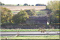
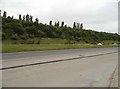
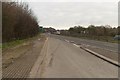
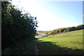
Photos of ME9 7PS


Area Information
Living in ME9 7PS offers a compact, residential experience within a 13.3-hectare area that accommodates 2,599 residents. The postcode covers a small cluster of homes, with a population density of 362 people per square kilometre. This is a mature community, with a median age of 47 and a majority of residents aged 30–64. The area is predominantly owner-occupied, with 80% of homes owned by residents, and houses are the primary accommodation type. Daily life here is shaped by proximity to key amenities, including five nearby rail stations and five retail outlets such as Asda Sittingbourne and Co-op Grove. The area’s small size means it is well-served by local services, though its limited scale may require residents to travel slightly further for specialist facilities. With a low crime risk and broadband connectivity rated 89 out of 100, ME9 7PS balances practicality with a sense of security. For families, the presence of a top-rated primary school adds to its appeal, though the area’s character is defined by its quiet, residential charm and close-knit community feel.
- Area Type
- Postcode
- Area Size
- 13.3 hectares
- Population
- 2599
- Population Density
- 362 people/km²
The property market in ME9 7PS is characterised by high home ownership, with 80% of homes owned by residents. This suggests a stable, long-term market with limited turnover, as opposed to a rental-dominated area. The primary accommodation type is houses, indicating a focus on family homes rather than apartments or flats. Given the area’s small size (13.3 hectares), the housing stock is likely limited, with buyers needing to consider proximity to the postcode’s boundaries for additional options. The dominance of owner-occupied properties may mean competition for available homes, particularly for those seeking to move into the area. For buyers, the presence of houses suggests a preference for private, detached living, which aligns with the community’s mature demographic. However, the limited size of ME9 7PS means that buyers may need to look beyond immediate surroundings for larger property choices. The market’s stability, combined with good connectivity and local schools, positions it as a practical choice for those prioritising security and established infrastructure over rapid growth or development.
House Prices in ME9 7PS
Showing 6 properties
| Address | Type | Beds | Baths | Last Sale Price | Last Sale Date | |
|---|---|---|---|---|---|---|
| Cold Store, Maidstone Road, Borden, ME9 7PS | Farm | - | - | - | - | |
| A Hinge And Sons, Wagon Loft, Cold Store, Maidstone Road, Borden, ME9 7PS | Farm | - | - | - | - | |
| 1, Cold Store Cottages, Maidstone Road, Borden, ME9 7PS | Semi-detached | - | - | - | - | |
| 2, Cold Store Cottages, Maidstone Road, Borden, ME9 7PS | house | - | - | - | - | |
| Wagon Loft, Danaway, Maidstone Road, Borden, ME9 7PS | office_workshop | - | - | - | - | |
| Rock Meadow, Maidstone Road, Borden, ME9 7PS | Detached | - | - | - | - |
Energy Efficiency in ME9 7PS
Life in ME9 7PS is shaped by its proximity to essential amenities, including five rail stations and five retail outlets. The nearby Asda Sittingbourne and Co-op Grove provide access to groceries, clothing, and household goods, while Budgens MRH adds further convenience for smaller purchases. The rail network, with stations like Newington and Kemsley, offers easy access to regional hubs, supporting both daily commutes and weekend travel. Though the area lacks detailed data on parks or leisure facilities, its small size suggests a focus on residential comfort rather than large-scale recreation. The presence of a high-performing primary school and low crime risk adds to the appeal of a family-friendly environment. For residents, the balance of practical amenities and quiet living makes ME9 7PS suitable for those prioritising accessibility and stability. The compact nature of the area means that while it is well-served by immediate needs, residents may need to venture slightly further for specialist services or entertainment. Nonetheless, the combination of retail, transport, and education ensures a functional lifestyle for most households.
Amenities
Schools
The nearest school to ME9 7PS is Borden Church of England Primary School, which serves the local community with an Ofsted rating of outstanding. This indicates a high standard of education for primary-aged children, though no secondary schools are listed in the data. The presence of a top-rated primary school is a significant draw for families, offering a reliable foundation for early education. However, residents with older children may need to travel to nearby towns for secondary schooling, as the area itself does not host such institutions. The school’s excellence suggests a focus on academic and pastoral care, which could be a key factor for parents prioritising quality education. Given the area’s small size, the school’s proximity to homes in ME9 7PS enhances its accessibility, making it a central feature of local life. For families, this combination of a high-performing primary school and the area’s residential character could be a compelling reason to consider ME9 7PS as a place to live.
| Rank | School | Type | Entry gender | Ages |
|---|
Explore more schools in this area
Go to Schools tabDemographics
ME9 7PS has a median age of 47, with the majority of residents falling within the 30–64 age range. This suggests a stable, adult-oriented population, likely with established careers and families. Home ownership is high at 80%, indicating a community of long-term residents rather than transient renters. The area is predominantly White, with no specific data on other ethnic groups provided. The population density of 362 people per square kilometre is moderate for a rural or semi-rural setting, suggesting a balance between privacy and accessibility. The age profile implies a focus on middle-aged and older adults, which may influence local services and amenities. With 80% of homes owned by residents, the area is less likely to experience rapid demographic shifts, contributing to a sense of continuity. However, the lack of detailed diversity data means the community’s full composition remains unclear. The presence of primary school-aged children, reflected in the local school’s Ofsted rating, hints at a family-friendly element, though the broader demographic picture is defined by its mature, owner-occupied population.
Household Size
Accommodation Type
Tenure
Ethnic Group
Religion
Household Composition
Age
Household Deprivation
NS-SEC
Explore more demographic insights in this area
Go to Demographics tabPlanning
Planning Constraints
- Flood RiskPremium
- Ramsar Wetland SitesPremium
- Area of Outstanding Natural BeautyPremium
- Protected Nature ReservePremium
- Protected WoodlandPremium