Area Overview for KT17 1NQ
Photos of KT17 1NQ
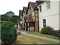
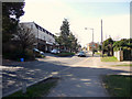
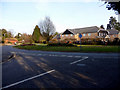
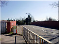
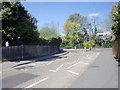
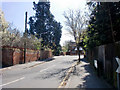


100 photos from this area
Area Information
Key information about the KT17 1NQ including its size, population, and administrative classification.
- Area Type
- Postcode
- Area Size
- 8081 m²
- Population
- 1909
- Population Density
- 5099 people/km²
House Prices in KT17 1NQ
13
Properties
£514,495
Average Sold Price
£249,950
Lowest Price
£725,000
Highest Price
Showing 13 properties
| Address | Type | Beds | Baths | Last Sale Price | Last Sale Date | |
|---|---|---|---|---|---|---|
| 15 West Gardens, Ewell, KT17 1NQ | Bungalow | 2 | 1 | £640,000 | Sep 2024 | |
| 9 West Gardens, Ewell, KT17 1NQ | Bungalow | 3 | 2 | £700,000 | Sep 2023 | |
| 7 West Gardens, Ewell, KT17 1NQ | Retail | 4 | 1 | £725,000 | Jan 2022 | |
| 25 West Gardens, Ewell, KT17 1NQ | Bungalow | 2 | 1 | £535,000 | Jun 2021 | |
| 3 West Gardens, Ewell, KT17 1NQ | Retail | 4 | 2 | £700,000 | Aug 2017 | |
| 23 West Gardens, Ewell, KT17 1NQ | Detached | 3 | 1 | £535,000 | Jun 2014 | |
| 5 West Gardens, Ewell, KT17 1NQ | Detached | - | - | £249,950 | Oct 2003 | |
| 21 West Gardens, Ewell, KT17 1NQ | Detached | - | - | £355,000 | Sep 2002 | |
| 19 West Gardens, Ewell, KT17 1NQ | Detached | - | - | £310,000 | Aug 2002 | |
| 13 West Gardens, Ewell, KT17 1NQ | house | - | - | £395,000 | Nov 2001 |
Page 1 of 2
Energy Efficiency in KT17 1NQ
Amenities
Schools
| Rank | School | Type | Entry gender | Ages |
|---|
Explore more schools in this area
Go to Schools tabDemographics
Household Size
Two person
most common
Accommodation Type
Houses
most common
Tenure
70
majority
Ethnic Group
White
most common
Religion
N/A
most common
Household Composition
N/A
most common
Age
47
median
Adults (30-64 years)
most common
Household Deprivation
N/A
with no deprivation
NS-SEC
45
in Lower managerial occupations
Explore more demographic insights in this area
Go to Demographics tabPlanning
Planning Constraints
- Flood RiskPremium
- Ramsar Wetland SitesPremium
- Area of Outstanding Natural BeautyPremium
- Protected Nature ReservePremium
- Protected WoodlandPremium