Area Overview for KT17 1LX
Photos of KT17 1LX
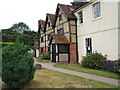
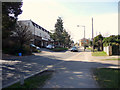

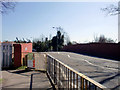
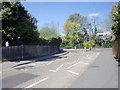

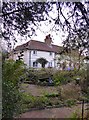

100 photos from this area
Area Information
Key information about the KT17 1LX including its size, population, and administrative classification.
- Area Type
- Postcode
- Area Size
- 9543 m²
- Population
- 1909
- Population Density
- 5099 people/km²
House Prices in KT17 1LX
12
Properties
£510,850
Average Sold Price
£219,000
Lowest Price
£782,000
Highest Price
Showing 12 properties
| Address | Type | Beds | Baths | Last Sale Price | Last Sale Date | |
|---|---|---|---|---|---|---|
| 37 The Kingsway, Ewell, KT17 1LX | Detached | 4 | 2 | £782,000 | Feb 2025 | |
| 39 The Kingsway, Ewell, KT17 1LX | Bungalow | 3 | 2 | £745,000 | Feb 2024 | |
| 40 The Kingsway, Ewell, KT17 1LX | Bungalow | 2 | 1 | £560,000 | Jun 2023 | |
| 34 The Kingsway, Ewell, KT17 1LX | house | - | - | £590,000 | Jul 2015 | |
| 32 The Kingsway, Ewell, KT17 1LX | Bungalow | - | - | £349,950 | Jun 2010 | |
| 35 The Kingsway, Ewell, KT17 1LX | Detached | - | - | £330,000 | Oct 2006 | |
| 31 The Kingsway, Ewell, KT17 1LX | Bungalow | - | - | £219,000 | Apr 1995 | |
| 33A The Kingsway, Ewell, KT17 1LX | Bungalow | 4 | 1 | - | - | |
| 36 The Kingsway, Ewell, KT17 1LX | Detached | - | - | - | - | |
| 33B The Kingsway, Ewell, KT17 1LX | Detached | - | - | - | - |
Page 1 of 2
Energy Efficiency in KT17 1LX
Amenities
Schools
| Rank | School | Type | Entry gender | Ages |
|---|
Explore more schools in this area
Go to Schools tabDemographics
Household Size
Two person
most common
Accommodation Type
Houses
most common
Tenure
70
majority
Ethnic Group
White
most common
Religion
N/A
most common
Household Composition
N/A
most common
Age
47
median
Adults (30-64 years)
most common
Household Deprivation
N/A
with no deprivation
NS-SEC
45
in Lower managerial occupations
Explore more demographic insights in this area
Go to Demographics tabPlanning
Planning Constraints
- Flood RiskPremium
- Ramsar Wetland SitesPremium
- Area of Outstanding Natural BeautyPremium
- Protected Nature ReservePremium
- Protected WoodlandPremium