Area Overview for KT16 8EP
Photos of KT16 8EP
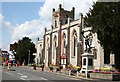
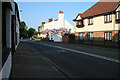
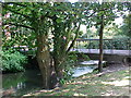
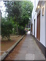
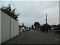
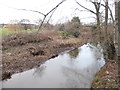
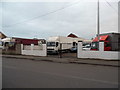
100 photos from this area
Area Information
Key information about the KT16 8EP including its size, population, and administrative classification.
- Area Type
- Postcode
- Area Size
- 1.0 hectares
- Population
- 1835
- Population Density
- 4561 people/km²
House Prices in KT16 8EP
40
Properties
£225,500
Average Sold Price
£57,500
Lowest Price
£385,000
Highest Price
Showing 40 properties
| Address | Type | Beds | Baths | Last Sale Price | Last Sale Date | |
|---|---|---|---|---|---|---|
| 46 Galsworthy Road, Chertsey, KT16 8EP | Terraced | 4 | 1 | £385,000 | Mar 2025 | |
| 59 Galsworthy Road, Chertsey, KT16 8EP | Terraced | 3 | 1 | £380,000 | Mar 2025 | |
| 64 Galsworthy Road, Chertsey, KT16 8EP | house | - | - | £325,000 | Jun 2021 | |
| 73 Galsworthy Road, Chertsey, KT16 8EP | Terraced | 3 | 1 | £305,000 | Jun 2020 | |
| 76 Galsworthy Road, Chertsey, KT16 8EP | Terraced | 3 | - | £290,000 | Jul 2016 | |
| 71 Galsworthy Road, Chertsey, KT16 8EP | Terraced | 2 | 1 | £200,000 | Oct 2012 | |
| 78 Galsworthy Road, Chertsey, KT16 8EP | Terraced | 3 | - | £230,000 | Jun 2011 | |
| 72 Galsworthy Road, Chertsey, KT16 8EP | house | 3 | - | £180,000 | Dec 2010 | |
| 54 Galsworthy Road, Chertsey, KT16 8EP | house | - | - | £61,000 | Apr 1997 | |
| 49 Galsworthy Road, Chertsey, KT16 8EP | house | - | - | £57,500 | Jan 1997 |
Page 1 of 4
Energy Efficiency in KT16 8EP
Amenities
Schools
| Rank | School | Type | Entry gender | Ages |
|---|
Explore more schools in this area
Go to Schools tabDemographics
Household Size
Two person
most common
Accommodation Type
Houses
most common
Tenure
60
majority
Ethnic Group
White
most common
Religion
N/A
most common
Household Composition
N/A
most common
Age
47
median
Adults (30-64 years)
most common
Household Deprivation
N/A
with no deprivation
NS-SEC
42
in Lower managerial occupations
Explore more demographic insights in this area
Go to Demographics tabPlanning
Planning Constraints
- Flood RiskPremium
- Ramsar Wetland SitesPremium
- Area of Outstanding Natural BeautyPremium
- Protected Nature ReservePremium
- Protected WoodlandPremium