Area Overview for KT16 9BU
Photos of KT16 9BU
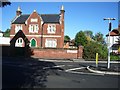
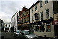
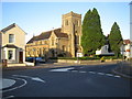
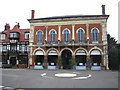
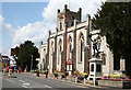
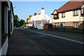
100 photos from this area
Area Information
Key information about the KT16 9BU including its size, population, and administrative classification.
- Area Type
- Postcode
- Area Size
- 2.7 hectares
- Population
- 1835
- Population Density
- 4561 people/km²
House Prices in KT16 9BU
46
Properties
£207,763
Average Sold Price
£61,000
Lowest Price
£375,000
Highest Price
Showing 46 properties
| Address | Type | Beds | Baths | Last Sale Price | Last Sale Date | |
|---|---|---|---|---|---|---|
| 20 Heriot Road, Chertsey, KT16 9BU | Terraced | 3 | 1 | £375,000 | Nov 2025 | |
| 6 Heriot Road, Chertsey, KT16 9BU | Semi-detached | 3 | 2 | £375,000 | Feb 2025 | |
| 27 Heriot Road, Chertsey, KT16 9BU | Terraced | 2 | 2 | £340,000 | Apr 2023 | |
| 16 Heriot Road, Chertsey, KT16 9BU | house | - | - | £315,000 | Jun 2021 | |
| 43 Heriot Road, Chertsey, KT16 9BU | Terraced | 3 | 1 | £325,000 | Apr 2019 | |
| 4 Heriot Road, Chertsey, KT16 9BU | house | 2 | 2 | £282,000 | Mar 2019 | |
| 26 Heriot Road, Chertsey, KT16 9BU | Terraced | 3 | 1 | £325,000 | Jul 2018 | |
| 29 Heriot Road, Chertsey, KT16 9BU | house | - | - | £290,000 | Nov 2014 | |
| 13 Heriot Road, Chertsey, KT16 9BU | house | 4 | - | £222,500 | May 2012 | |
| 42 Heriot Road, Chertsey, KT16 9BU | Terraced | 3 | 1 | £185,000 | Sep 2006 |
Page 1 of 5
Energy Efficiency in KT16 9BU
Amenities
Schools
| Rank | School | Type | Entry gender | Ages |
|---|
Explore more schools in this area
Go to Schools tabDemographics
Household Size
Two person
most common
Accommodation Type
Houses
most common
Tenure
60
majority
Ethnic Group
White
most common
Religion
N/A
most common
Household Composition
N/A
most common
Age
47
median
Adults (30-64 years)
most common
Household Deprivation
N/A
with no deprivation
NS-SEC
42
in Lower managerial occupations
Explore more demographic insights in this area
Go to Demographics tabPlanning
Planning Constraints
- Flood RiskPremium
- Ramsar Wetland SitesPremium
- Area of Outstanding Natural BeautyPremium
- Protected Nature ReservePremium
- Protected WoodlandPremium