Area Overview for KT12 2SY
Photos of KT12 2SY
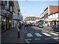
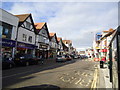
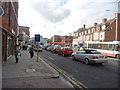
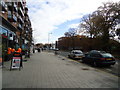
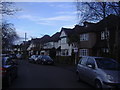

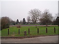
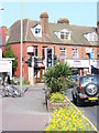


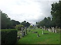
72 photos from this area
Area Information
Key information about the KT12 2SY including its size, population, and administrative classification.
- Area Type
- Postcode
- Area Size
- 9006 m²
- Population
- 1597
- Population Density
- 6385 people/km²
House Prices in KT12 2SY
25
Properties
£571,291
Average Sold Price
£65,000
Lowest Price
£1,232,500
Highest Price
Showing 25 properties
| Address | Type | Beds | Baths | Last Sale Price | Last Sale Date | |
|---|---|---|---|---|---|---|
| 46 Churchfield Road, Walton On Thames, KT12 2SY | Detached | 3 | 1 | £685,000 | Feb 2025 | |
| 48 Churchfield Road, Walton On Thames, KT12 2SY | Terraced | 3 | 1 | £875,000 | Feb 2023 | |
| 54 Churchfield Road, Walton On Thames, KT12 2SY | Retail | 4 | 1 | £1,232,500 | Nov 2022 | |
| 28 Churchfield Road, Walton On Thames, KT12 2SY | house | - | - | £534,750 | Jun 2021 | |
| 22 Churchfield Road, Walton On Thames, KT12 2SY | house | 3 | - | £775,000 | Jun 2021 | |
| 44 Churchfield Road, Walton On Thames, KT12 2SY | Detached | 3 | 2 | £645,000 | Feb 2021 | |
| 18 Churchfield Road, Walton On Thames, KT12 2SY | Semi-detached | 3 | - | £615,000 | Jul 2015 | |
| Churchfield Cottage, 30 Churchfield Road, Walton On Thames, KT12 2SY | Semi-detached | 1 | 1 | £380,000 | Aug 2010 | |
| 52 Churchfield Road, Walton On Thames, KT12 2SY | Detached | - | - | £314,000 | Jul 2006 | |
| 34 Churchfield Road, Walton On Thames, KT12 2SY | Terraced | - | - | £162,950 | Aug 1999 |
Page 1 of 3
Energy Efficiency in KT12 2SY
Amenities
Schools
| Rank | School | Type | Entry gender | Ages |
|---|
Explore more schools in this area
Go to Schools tabDemographics
Household Size
Family (3-5 people)
most common
Accommodation Type
Houses
most common
Tenure
81
majority
Ethnic Group
White
most common
Religion
N/A
most common
Household Composition
N/A
most common
Age
47
median
Adults (30-64 years)
most common
Household Deprivation
N/A
with no deprivation
NS-SEC
46
in Lower managerial occupations
Explore more demographic insights in this area
Go to Demographics tabPlanning
Planning Constraints
- Flood RiskPremium
- Ramsar Wetland SitesPremium
- Area of Outstanding Natural BeautyPremium
- Protected Nature ReservePremium
- Protected WoodlandPremium