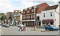
Area Overview for KT12 2FR
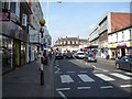
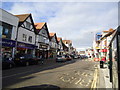
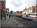
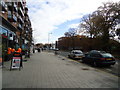
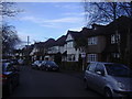
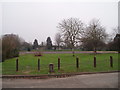
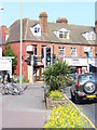
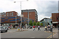
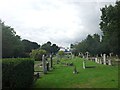
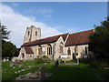
Photos of KT12 2FR

Area Information
Living in KT12 2FR offers a distinct experience within a compact residential cluster. This specific postcode covers just 1,987 square metres, creating a space-efficient environment that feels insulated from the sprawl surrounding it. You will find no shortage of neighbours, with a population of 1,597 people calling this area home. The density here is notable, with 803,765 people per square kilometre recorded in the data, which suggests a tightly knit community where residents know one another. Daily life in KT12 2FR centres on the convenience of immediate access to key transport hubs. You can reach Walton, Hersham, Shepperton, Moulsey, Hatton Cross, and Hounslow West with relative ease. The area sits close to four airports and maintains strong links to Heathrow Central Bus Station. Despite its small footprint, the location provides practical connectivity for commuters and travellers without the need for long journeys into more distant cities. The character of KT12 2FR is defined by its focus on houses rather than flats. This房型 choice shapes the domestic landscape, offering more space for families and individuals alike. You are entering an environment where home ownership is the norm, supported by a community that has settled here for the long term. The area avoids complex planning constraints associated with protected status or environmental restrictions, ensuring stability for future developments and improvements.
- Area Type
- Postcode
- Area Size
- 1987 m²
- Population
- 1597
- Population Density
- 6385 people/km²
The property market in KT12 2FR is defined by a strong preference for ownership. You will find that 81 per cent of residents own their homes, which signals a mature market where sales are driven by enthusiasts of domestic life rather than speculative investors. The accommodation type data shows that houses are the standard, meaning you cannot find significant blocks of flats or converted apartments within this specific postcode. This area represents a niche segment of the wider KT12 market. You are looking at a residential cluster where the housing stock has catered primarily to those securing a permanent base. The low population count of 1,597, confined to just 1,987 square metres, indicates a high value density where properties command a premium for their location and status. There is little room for large-scale new builds, as the physical space is limited. For buyers considering KT12 2FR, the key insight is the stability of the stock. You will not encounter the fluidity typical of student hotspots or young professional enclaves. Instead, the market serves families and individuals who have settled down. The prevalence of houses suggests that buyers here prioritise land and structure over the convenience of block living. This creates a property environment where transactions are serious and the residents are invested in their neighbourhood.
House Prices in KT12 2FR
Showing 51 properties
Energy Efficiency in KT12 2FR
Your daily life in KT12 2FR is supported by a ring of accessible amenities that extend just beyond the postcode boundary. For retail needs, you can visit M&S Walton, Aldi Bridge Street Walton on, and Sainsburys Walton. These stores provide a standard range of goods without forcing you to travel far into town. The presence of five major retail sites nearby ensures you are rarely without access to groceries and household essentials. Transport options in KT12 2FR are surprisingly diverse. You have five railway stations at your disposal, including the notable stations at Walton and Hersham. Ferry services add a unique dimension to your commute, with landings available at Weybridge and Moulsey. Four airports sit nearby, and two metro stations like Hatton Cross offer underground connections to central London. Even bus services are available, linking you to Heathrow Central Bus Station. This mix of transport modes gives you the freedom to choose how you travel. You might take a train to Waterloo, a ferry to Richmond, or a bus to Heathrow. The variety of options means you are not locked into a single commute routine. Retail availability complements this, allowing you to manage weekly shopping without relying solely on supermarkets in larger towns. Living in KT12 2FR means balancing the quiet of a residential cluster with the convenience of major regional amenities.
Amenities
Schools
| Rank | School | Type | Entry gender | Ages |
|---|
Explore more schools in this area
Go to Schools tabDemographics
The community in KT12 2FR reflects a mature and established demographic profile. The median age stands at 47 years, indicating that the area attracts a population well into middle age and beyond. Most residents fall within the 30 to 64-year-old bracket, which drives a demand for stable living arrangements rather than temporary accommodation. Eighty-one per cent of households in KT12 2FR own their homes, creating a neighbourhood where long-term stability is the priority. This high ownership rate contrasts with the larger rental markets common in London suburbs. You will predominantly encounter houses, which aligns with the preferences of owners seeking space and permanence. The predominant ethnic group in this postcode is White, reflecting the traditional composition of many settled areas in Surrey. With a population of 1,597, you are dealing with a small, close-knit group rather than a sprawling diverse metropolis. The accommodation type data confirms that flats are not the primary focus here. Instead, houses dominate the landscape, catering to those who value private gardens or larger living spaces. This demographic consistency means you can expect a quiet, familiar atmosphere where neighbours look out for one another. The community feels like a family unit rather than a transient collection of tenants.
Household Size
Accommodation Type
Tenure
Ethnic Group
Religion
Household Composition
Age
Household Deprivation
NS-SEC
Explore more demographic insights in this area
Go to Demographics tabPlanning
Planning Constraints
- Flood RiskPremium
- Ramsar Wetland SitesPremium
- Area of Outstanding Natural BeautyPremium
- Protected Nature ReservePremium
- Protected WoodlandPremium