Area Overview for HP14 3SG
Photos of HP14 3SG
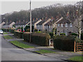
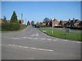
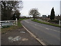
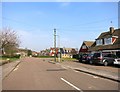
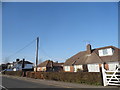
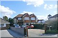
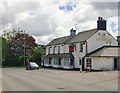
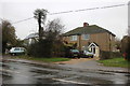
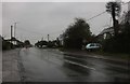
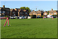

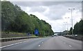
23 photos from this area
Area Information
Key information about the HP14 3SG including its size, population, and administrative classification.
- Area Type
- Postcode
- Area Size
- 2.6 hectares
- Population
- 1444
- Population Density
- 114 people/km²
House Prices in HP14 3SG
22
Properties
£307,083
Average Sold Price
£119,000
Lowest Price
£535,000
Highest Price
Showing 22 properties
| Address | Type | Beds | Baths | Last Sale Price | Last Sale Date | |
|---|---|---|---|---|---|---|
| 20 Butterly Road, Stokenchurch, HP14 3SG | Semi-detached | 3 | 1 | £430,000 | Aug 2024 | |
| 1 Butterly Road, Stokenchurch, HP14 3SG | Semi-detached | 3 | 1 | £535,000 | Jul 2023 | |
| 16 Butterly Road, Stokenchurch, HP14 3SG | Semi-detached | 3 | 1 | £380,000 | Mar 2020 | |
| 10 Butterly Road, Stokenchurch, HP14 3SG | Semi-detached | 3 | - | £370,000 | Jul 2016 | |
| 21 Butterly Road, Stokenchurch, HP14 3SG | house | - | - | £310,000 | Nov 2011 | |
| 5 Butterly Road, Stokenchurch, HP14 3SG | Detached | 3 | 1 | £307,500 | Jul 2011 | |
| 19 Butterly Road, Stokenchurch, HP14 3SG | Semi-detached | - | - | £302,500 | Jul 2008 | |
| 15 Butterly Road, Stokenchurch, HP14 3SG | Semi-detached | - | - | £295,000 | Jun 2008 | |
| Sandbach House, Butterly Road, Stokenchurch, HP14 3SG | Detached | - | - | £312,500 | Aug 2005 | |
| 2 Butterly Road, Stokenchurch, HP14 3SG | Semi-detached | 3 | 1 | £170,000 | Nov 2000 |
Page 1 of 3
Energy Efficiency in HP14 3SG
Amenities
Schools
| Rank | School | Type | Entry gender | Ages |
|---|
Explore more schools in this area
Go to Schools tabDemographics
Household Size
Family (3-5 people)
most common
Accommodation Type
Houses
most common
Tenure
79
majority
Ethnic Group
White
most common
Religion
N/A
most common
Household Composition
N/A
most common
Age
47
median
Adults (30-64 years)
most common
Household Deprivation
N/A
with no deprivation
NS-SEC
34
in Lower managerial occupations
Explore more demographic insights in this area
Go to Demographics tabPlanning
Planning Constraints
- Flood RiskPremium
- Ramsar Wetland SitesPremium
- Area of Outstanding Natural BeautyPremium
- Protected Nature ReservePremium
- Protected WoodlandPremium