Area Overview for HP14 3RT
Photos of HP14 3RT
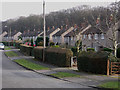
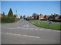
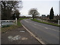
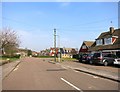
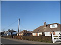
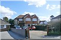
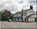
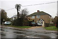

23 photos from this area
Area Information
Key information about the HP14 3RT including its size, population, and administrative classification.
- Area Type
- Postcode
- Area Size
- 5.4 hectares
- Population
- 1444
- Population Density
- 114 people/km²
House Prices in HP14 3RT
39
Properties
£360,678
Average Sold Price
£87,000
Lowest Price
£690,000
Highest Price
Showing 39 properties
| Address | Type | Beds | Baths | Last Sale Price | Last Sale Date | |
|---|---|---|---|---|---|---|
| 6 New Road, Stokenchurch, HP14 3RT | Bungalow | 3 | 1 | £465,000 | Feb 2025 | |
| 20 New Road, Stokenchurch, HP14 3RT | house | 4 | 2 | £690,000 | Aug 2024 | |
| 22 New Road, Stokenchurch, HP14 3RT | Bungalow | 3 | 1 | £498,000 | Jul 2024 | |
| 26 New Road, Stokenchurch, HP14 3RT | Detached | 4 | 2 | £635,000 | Jun 2021 | |
| 1 New Road, Stokenchurch, HP14 3RT | Terraced | 4 | 2 | £400,000 | Oct 2020 | |
| 15 New Road, Stokenchurch, HP14 3RT | Detached | 4 | 3 | £550,000 | Jul 2020 | |
| 13 New Road, Stokenchurch, HP14 3RT | Detached | 4 | 3 | £590,000 | Dec 2018 | |
| Hawthorns, 28A New Road, Stokenchurch, HP14 3RT | Detached | 4 | - | £535,000 | Feb 2017 | |
| 14 New Road, Stokenchurch, HP14 3RT | Bungalow | 5 | 3 | £572,000 | Nov 2014 | |
| 26A New Road, Stokenchurch, HP14 3RT | Detached | 4 | 1 | £463,500 | Dec 2012 |
Page 1 of 4
Energy Efficiency in HP14 3RT
Amenities
Schools
| Rank | School | Type | Entry gender | Ages |
|---|
Explore more schools in this area
Go to Schools tabDemographics
Household Size
Family (3-5 people)
most common
Accommodation Type
Houses
most common
Tenure
79
majority
Ethnic Group
White
most common
Religion
N/A
most common
Household Composition
N/A
most common
Age
47
median
Adults (30-64 years)
most common
Household Deprivation
N/A
with no deprivation
NS-SEC
34
in Lower managerial occupations
Explore more demographic insights in this area
Go to Demographics tabPlanning
Planning Constraints
- Flood RiskPremium
- Ramsar Wetland SitesPremium
- Area of Outstanding Natural BeautyPremium
- Protected Nature ReservePremium
- Protected WoodlandPremium