Area Overview for GU34 2PE
Photos of GU34 2PE


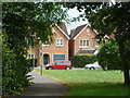
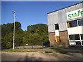

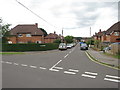
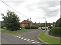


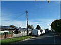

61 photos from this area
Area Information
Key information about the GU34 2PE including its size, population, and administrative classification.
- Area Type
- Postcode
- Area Size
- 9754 m²
- Population
- 1928
- Population Density
- 2872 people/km²
House Prices in GU34 2PE
29
Properties
£224,417
Average Sold Price
£62,000
Lowest Price
£370,000
Highest Price
Showing 29 properties
| Address | Type | Beds | Baths | Last Sale Price | Last Sale Date | |
|---|---|---|---|---|---|---|
| 21 Link Road, Alton, GU34 2PE | Terraced | 3 | 1 | £325,000 | Jul 2025 | |
| 5 Link Road, Alton, GU34 2PE | house | - | - | £290,000 | Mar 2025 | |
| 24 Link Road, Alton, GU34 2PE | Terraced | 3 | 2 | £370,000 | Aug 2022 | |
| 7 Link Road, Alton, GU34 2PE | Retail | 3 | 1 | £335,000 | Apr 2022 | |
| 3 Link Road, Alton, GU34 2PE | house | - | - | £297,000 | Feb 2022 | |
| 20 Link Road, Alton, GU34 2PE | house | - | - | £292,500 | Jun 2021 | |
| 11 Link Road, Alton, GU34 2PE | Semi-detached | - | - | £200,000 | Apr 2006 | |
| 23 Link Road, Alton, GU34 2PE | Terraced | 3 | 1 | £140,000 | Dec 2005 | |
| 1 Link Road, Alton, GU34 2PE | house | - | - | £175,999 | Aug 2005 | |
| 26 Link Road, Alton, GU34 2PE | house | - | - | £123,000 | Jul 2001 |
Page 1 of 3
Energy Efficiency in GU34 2PE
Amenities
Schools
| Rank | School | Type | Entry gender | Ages |
|---|
Explore more schools in this area
Go to Schools tabDemographics
Household Size
Family (3-5 people)
most common
Accommodation Type
Houses
most common
Tenure
54
majority
Ethnic Group
White
most common
Religion
N/A
most common
Household Composition
N/A
most common
Age
47
median
Adults (30-64 years)
most common
Household Deprivation
N/A
with no deprivation
NS-SEC
31
in Lower managerial occupations
Explore more demographic insights in this area
Go to Demographics tabPlanning
Planning Constraints
- Flood RiskPremium
- Ramsar Wetland SitesPremium
- Area of Outstanding Natural BeautyPremium
- Protected Nature ReservePremium
- Protected WoodlandPremium