Area Overview for GU34 2PB
Photos of GU34 2PB
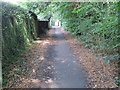
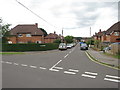
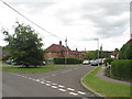
61 photos from this area
Area Information
Key information about the GU34 2PB including its size, population, and administrative classification.
- Area Type
- Postcode
- Area Size
- 10.4 hectares
- Population
- 2112
- Population Density
- 694 people/km²
House Prices in GU34 2PB
39
Properties
£218,079
Average Sold Price
£25,000
Lowest Price
£317,500
Highest Price
Showing 39 properties
| Address | Type | Beds | Baths | Last Sale Price | Last Sale Date | |
|---|---|---|---|---|---|---|
| 35 Manor Road, Alton, GU34 2PB | Semi-detached | 2 | 1 | £313,000 | Jul 2023 | |
| 20 Manor Road, Alton, GU34 2PB | Semi-detached | 2 | 1 | £270,000 | Feb 2023 | |
| 68 Manor Road, Alton, GU34 2PB | Semi-detached | 3 | 2 | £317,500 | Feb 2023 | |
| Willows, 23 Manor Road, Alton, GU34 2PB | Semi-detached | 3 | 1 | £295,500 | Sep 2019 | |
| 22 Manor Road, Alton, GU34 2PB | Semi-detached | 3 | 1 | £265,000 | Jul 2018 | |
| 39 Manor Road, Alton, GU34 2PB | Semi-detached | 2 | 1 | £260,000 | Apr 2017 | |
| 64 Manor Road, Alton, GU34 2PB | house | - | - | £210,000 | Mar 2014 | |
| 24 Manor Road, Alton, GU34 2PB | house | - | - | £229,950 | Oct 2013 | |
| 31 Manor Road, Alton, GU34 2PB | Terraced | - | - | £186,000 | Apr 2006 | |
| 25 Manor Road, Alton, GU34 2PB | Semi-detached | - | - | £165,000 | May 2003 |
Page 1 of 4
Energy Efficiency in GU34 2PB
Amenities
Schools
| Rank | School | Type | Entry gender | Ages |
|---|
Explore more schools in this area
Go to Schools tabDemographics
Household Size
Two person
most common
Accommodation Type
Houses
most common
Tenure
77
majority
Ethnic Group
White
most common
Religion
N/A
most common
Household Composition
N/A
most common
Age
47
median
Adults (30-64 years)
most common
Household Deprivation
N/A
with no deprivation
NS-SEC
45
in Lower managerial occupations
Explore more demographic insights in this area
Go to Demographics tabPlanning
Planning Constraints
- Flood RiskPremium
- Ramsar Wetland SitesPremium
- Area of Outstanding Natural BeautyPremium
- Protected Nature ReservePremium
- Protected WoodlandPremium