Area Overview for GU34 2NT
Photos of GU34 2NT
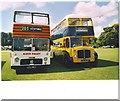
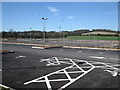
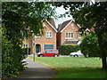
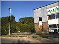
61 photos from this area
Area Information
Key information about the GU34 2NT including its size, population, and administrative classification.
- Area Type
- Postcode
- Area Size
- 1.0 hectares
- Population
- 1928
- Population Density
- 2872 people/km²
House Prices in GU34 2NT
42
Properties
£184,913
Average Sold Price
£66,000
Lowest Price
£350,000
Highest Price
Showing 42 properties
| Address | Type | Beds | Baths | Last Sale Price | Last Sale Date | |
|---|---|---|---|---|---|---|
| 29 Baverstocks, Alton, GU34 2NT | Retail | 3 | 1 | £350,000 | Feb 2022 | |
| 8 Baverstocks, Alton, GU34 2NT | Retail | 3 | 1 | £287,000 | Dec 2021 | |
| 10 Baverstocks, Alton, GU34 2NT | Terraced | 3 | 1 | £257,500 | Jul 2021 | |
| 17 Baverstocks, Alton, GU34 2NT | Terraced | 3 | - | £240,000 | Jan 2019 | |
| 28 Baverstocks, Alton, GU34 2NT | Terraced | - | - | £189,000 | May 2006 | |
| 27 Baverstocks, Alton, GU34 2NT | house | - | - | £169,000 | May 2005 | |
| 37 Baverstocks, Alton, GU34 2NT | house | - | - | £163,000 | Jan 2005 | |
| 25 Baverstocks, Alton, GU34 2NT | Terraced | - | - | £160,000 | Jul 2004 | |
| 25A Baverstocks, Alton, GU34 2NT | Terraced | - | - | £158,500 | Nov 2003 | |
| 12 Baverstocks, Alton, GU34 2NT | house | - | - | £105,000 | Oct 2002 |
Page 1 of 5
Energy Efficiency in GU34 2NT
Amenities
Schools
| Rank | School | Type | Entry gender | Ages |
|---|
Explore more schools in this area
Go to Schools tabDemographics
Household Size
Family (3-5 people)
most common
Accommodation Type
Houses
most common
Tenure
54
majority
Ethnic Group
White
most common
Religion
N/A
most common
Household Composition
N/A
most common
Age
47
median
Adults (30-64 years)
most common
Household Deprivation
N/A
with no deprivation
NS-SEC
31
in Lower managerial occupations
Explore more demographic insights in this area
Go to Demographics tabPlanning
Planning Constraints
- Flood RiskPremium
- Ramsar Wetland SitesPremium
- Area of Outstanding Natural BeautyPremium
- Protected Nature ReservePremium
- Protected WoodlandPremium