Area Overview for GU14 9UR
Photos of GU14 9UR
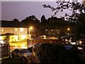
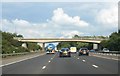
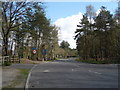
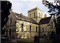
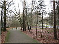
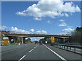
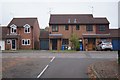
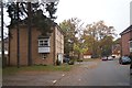
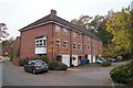
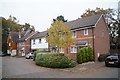
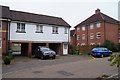
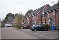
53 photos from this area
Area Information
Key information about the GU14 9UR including its size, population, and administrative classification.
- Area Type
- Postcode
- Area Size
- 1.5 hectares
- Population
- 2477
- Population Density
- 6113 people/km²
House Prices in GU14 9UR
62
Properties
£308,311
Average Sold Price
£177,000
Lowest Price
£475,000
Highest Price
Showing 62 properties
| Address | Type | Beds | Baths | Last Sale Price | Last Sale Date | |
|---|---|---|---|---|---|---|
| 48 Maple Avenue, Farnborough, GU14 9UR | Semi-detached | 3 | 2 | £410,000 | Nov 2025 | |
| 44 Maple Avenue, Farnborough, GU14 9UR | house | 3 | 2 | £450,000 | Oct 2025 | |
| 53 Maple Avenue, Farnborough, GU14 9UR | Terraced | 2 | 2 | £360,000 | Sep 2025 | |
| 51 Maple Avenue, Farnborough, GU14 9UR | Terraced | 2 | 2 | £358,000 | Sep 2025 | |
| 29 Maple Avenue, Farnborough, GU14 9UR | Terraced | 2 | 2 | £365,000 | Aug 2025 | |
| 24 Maple Avenue, Farnborough, GU14 9UR | Terraced | 2 | 2 | £350,000 | Jan 2025 | |
| 2 Maple Avenue, Farnborough, GU14 9UR | Detached | 4 | 2 | £450,000 | Apr 2024 | |
| 57 Maple Avenue, Farnborough, GU14 9UR | Terraced | 4 | 3 | £475,000 | Sep 2023 | |
| 35 Maple Avenue, Farnborough, GU14 9UR | Terraced | 2 | 1 | £346,000 | Mar 2023 | |
| 58 Maple Avenue, Farnborough, GU14 9UR | Semi-detached | 2 | 2 | £261,000 | Feb 2023 |
Page 1 of 7
Energy Efficiency in GU14 9UR
Amenities
Schools
| Rank | School | Type | Entry gender | Ages |
|---|
Explore more schools in this area
Go to Schools tabDemographics
Household Size
Family (3-5 people)
most common
Accommodation Type
Houses
most common
Tenure
68
majority
Ethnic Group
White
most common
Religion
N/A
most common
Household Composition
N/A
most common
Age
47
median
Adults (30-64 years)
most common
Household Deprivation
N/A
with no deprivation
NS-SEC
36
in Lower managerial occupations
Explore more demographic insights in this area
Go to Demographics tabPlanning
Planning Constraints
- Flood RiskPremium
- Ramsar Wetland SitesPremium
- Area of Outstanding Natural BeautyPremium
- Protected Nature ReservePremium
- Protected WoodlandPremium