Area Overview for GU14 9UP
Photos of GU14 9UP
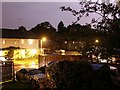
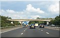
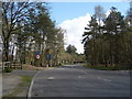
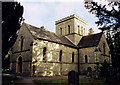
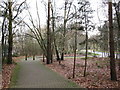
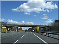
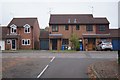
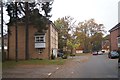
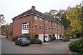
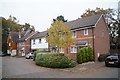
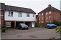
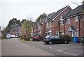
53 photos from this area
Area Information
Key information about the GU14 9UP including its size, population, and administrative classification.
- Area Type
- Postcode
- Area Size
- 9255 m²
- Population
- 2477
- Population Density
- 6113 people/km²
House Prices in GU14 9UP
37
Properties
£303,289
Average Sold Price
£218,495
Lowest Price
£500,000
Highest Price
Showing 37 properties
| Address | Type | Beds | Baths | Last Sale Price | Last Sale Date | |
|---|---|---|---|---|---|---|
| 32 Silver Birch Way, Farnborough, GU14 9UP | Semi-detached | 3 | 2 | £435,000 | Dec 2024 | |
| 12 Silver Birch Way, Farnborough, GU14 9UP | Semi-detached | 4 | 3 | £500,000 | Oct 2024 | |
| 2 Silver Birch Way, Farnborough, GU14 9UP | Terraced | 2 | 2 | £350,000 | Jul 2023 | |
| 24 Silver Birch Way, Farnborough, GU14 9UP | Terraced | 2 | 2 | £330,000 | Mar 2023 | |
| 6 Silver Birch Way, Farnborough, GU14 9UP | Retail | 2 | 2 | £325,000 | Sep 2022 | |
| 7 Silver Birch Way, Farnborough, GU14 9UP | Semi-detached | 3 | 2 | £365,000 | Dec 2021 | |
| 27 Silver Birch Way, Farnborough, GU14 9UP | Semi-detached | 3 | 2 | £360,000 | Apr 2021 | |
| 8 Silver Birch Way, Farnborough, GU14 9UP | house | - | - | £305,000 | Feb 2021 | |
| 48 Silver Birch Way, Farnborough, GU14 9UP | Terraced | 3 | 2 | £327,500 | Dec 2020 | |
| 42 Silver Birch Way, Farnborough, GU14 9UP | house | - | - | £325,000 | Jan 2019 |
Page 1 of 4
Energy Efficiency in GU14 9UP
Amenities
Schools
| Rank | School | Type | Entry gender | Ages |
|---|
Explore more schools in this area
Go to Schools tabDemographics
Household Size
Family (3-5 people)
most common
Accommodation Type
Houses
most common
Tenure
68
majority
Ethnic Group
White
most common
Religion
N/A
most common
Household Composition
N/A
most common
Age
47
median
Adults (30-64 years)
most common
Household Deprivation
N/A
with no deprivation
NS-SEC
36
in Lower managerial occupations
Explore more demographic insights in this area
Go to Demographics tabPlanning
Planning Constraints
- Flood RiskPremium
- Ramsar Wetland SitesPremium
- Area of Outstanding Natural BeautyPremium
- Protected Nature ReservePremium
- Protected WoodlandPremium