Area Overview for GU14 8PY
Photos of GU14 8PY
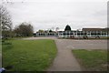
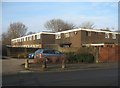
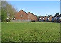
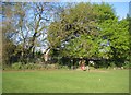
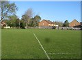
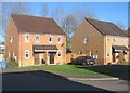
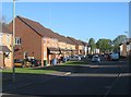
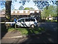
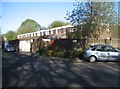
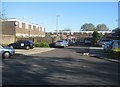
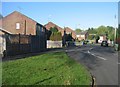
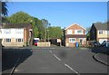
100 photos from this area
Area Information
Key information about the GU14 8PY including its size, population, and administrative classification.
- Area Type
- Postcode
- Area Size
- 1.1 hectares
- Population
- 1320
- Population Density
- 4760 people/km²
House Prices in GU14 8PY
31
Properties
£262,573
Average Sold Price
£62,000
Lowest Price
£480,000
Highest Price
Showing 31 properties
| Address | Type | Beds | Baths | Last Sale Price | Last Sale Date | |
|---|---|---|---|---|---|---|
| 1 Coleville Road, Farnborough, GU14 8PY | Maisonette | 2 | 1 | £260,000 | Aug 2025 | |
| 33 Coleville Road, Farnborough, GU14 8PY | Semi-detached | 3 | 1 | £450,000 | Mar 2025 | |
| 12 Coleville Road, Farnborough, GU14 8PY | Retail | 3 | 1 | £480,000 | Aug 2022 | |
| 4 Coleville Road, Farnborough, GU14 8PY | Flat | 2 | 1 | £255,000 | Mar 2022 | |
| 11 Coleville Road, Farnborough, GU14 8PY | house | - | - | £330,000 | Jun 2021 | |
| 24 Coleville Road, Farnborough, GU14 8PY | Flat | - | - | £220,000 | Jan 2021 | |
| 3 Coleville Road, Farnborough, GU14 8PY | Maisonette | 2 | 1 | £242,500 | Nov 2019 | |
| 19 Coleville Road, Farnborough, GU14 8PY | Semi-detached | 3 | 1 | £375,000 | Nov 2018 | |
| 9 Coleville Road, Farnborough, GU14 8PY | Semi-detached | 3 | 1 | £365,000 | May 2018 | |
| 14 Coleville Road, Farnborough, GU14 8PY | Semi-detached | 3 | - | £370,000 | Mar 2017 |
Page 1 of 4
Energy Efficiency in GU14 8PY
Amenities
Schools
| Rank | School | Type | Entry gender | Ages |
|---|
Explore more schools in this area
Go to Schools tabDemographics
Household Size
Two person
most common
Accommodation Type
Houses
most common
Tenure
78
majority
Ethnic Group
White
most common
Religion
N/A
most common
Household Composition
N/A
most common
Age
47
median
Adults (30-64 years)
most common
Household Deprivation
N/A
with no deprivation
NS-SEC
38
in Lower managerial occupations
Explore more demographic insights in this area
Go to Demographics tabPlanning
Planning Constraints
- Flood RiskPremium
- Ramsar Wetland SitesPremium
- Area of Outstanding Natural BeautyPremium
- Protected Nature ReservePremium
- Protected WoodlandPremium