Area Overview for GU14 8PN
Photos of GU14 8PN
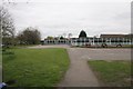
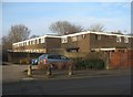
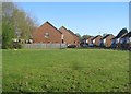

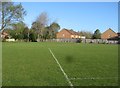
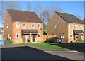
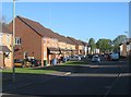

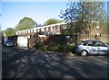

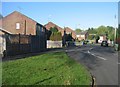
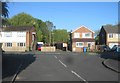
100 photos from this area
Area Information
Key information about the GU14 8PN including its size, population, and administrative classification.
- Area Type
- Postcode
- Area Size
- 1.2 hectares
- Population
- 1320
- Population Density
- 4760 people/km²
House Prices in GU14 8PN
28
Properties
£285,788
Average Sold Price
£159,970
Lowest Price
£435,000
Highest Price
Showing 28 properties
| Address | Type | Beds | Baths | Last Sale Price | Last Sale Date | |
|---|---|---|---|---|---|---|
| 15 Clouston Road, Farnborough, GU14 8PN | Bungalow | 2 | 1 | £375,000 | Jun 2024 | |
| 1 Clouston Road, Farnborough, GU14 8PN | Bungalow | - | - | £200,000 | Apr 2024 | |
| 27 Clouston Road, Farnborough, GU14 8PN | Retail | 3 | 1 | £435,000 | Jul 2022 | |
| 26 Clouston Road, Farnborough, GU14 8PN | Bungalow | 2 | 1 | £385,000 | Jan 2022 | |
| 19 Clouston Road, Farnborough, GU14 8PN | Bungalow | - | - | £410,000 | Nov 2021 | |
| 20 Clouston Road, Farnborough, GU14 8PN | Bungalow | 2 | 1 | £335,000 | Feb 2021 | |
| 18 Clouston Road, Farnborough, GU14 8PN | Semi-detached | 3 | 1 | £335,000 | Oct 2020 | |
| 2 Clouston Road, Farnborough, GU14 8PN | Semi-detached | 2 | 3 | £372,500 | Apr 2020 | |
| 16 Clouston Road, Farnborough, GU14 8PN | Bungalow | 2 | - | £330,000 | Sep 2018 | |
| 10 Clouston Road, Farnborough, GU14 8PN | Bungalow | - | - | £303,000 | Nov 2016 |
Page 1 of 3
Energy Efficiency in GU14 8PN
Amenities
Schools
| Rank | School | Type | Entry gender | Ages |
|---|
Explore more schools in this area
Go to Schools tabDemographics
Household Size
Two person
most common
Accommodation Type
Houses
most common
Tenure
78
majority
Ethnic Group
White
most common
Religion
N/A
most common
Household Composition
N/A
most common
Age
47
median
Adults (30-64 years)
most common
Household Deprivation
N/A
with no deprivation
NS-SEC
38
in Lower managerial occupations
Explore more demographic insights in this area
Go to Demographics tabPlanning
Planning Constraints
- Flood RiskPremium
- Ramsar Wetland SitesPremium
- Area of Outstanding Natural BeautyPremium
- Protected Nature ReservePremium
- Protected WoodlandPremium