Area Overview for GU14 6PA
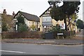
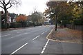
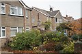
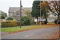
Photos of GU14 6PA
Area Information
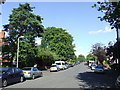
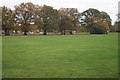
Living in GU14 6PA means being part of a tightly knit residential cluster in England, where 1,374 people reside across 8,038 square metres. The area’s high population density of 170,930 people per square kilometre reflects a compact, closely spaced community. This postcode is ideal for those seeking a quiet, established neighbourhood with easy access to nearby amenities. Daily life here is shaped by proximity to retail, transport, and educational hubs, making it practical for families and professionals. The area’s small size means a strong sense of local identity, with residents likely to know their neighbours. While it lacks large-scale infrastructure, its strategic location near rail networks and airports offers connectivity without urban sprawl. For buyers, GU14 6PA presents a chance to own a home in a space where community and convenience intersect, though the limited land area means properties are likely to be closely spaced.
- Area Type
- Postcode
- Area Size
- 8038 m²
- Population
- 1374
- Population Density
- 6515 people/km²
GU14 6PA is a largely owner-occupied area, with 68% of homes owned by residents rather than rented. The housing stock is dominated by houses, not flats, which suggests a focus on family homes and traditional property types. Given the area’s small size and high population density, the available housing is likely limited, making it a niche market for buyers seeking a specific location. The compact nature of the postcode means properties are closely spaced, which could appeal to those prioritising proximity to amenities over expansive gardens. For buyers, this area may offer a chance to secure a home in a stable, established neighbourhood, though the limited land area may restrict options for larger properties.
House Prices in GU14 6PA
Showing 1 properties
| Address | Type | Beds | Baths | Last Sale Price | Last Sale Date | |
|---|---|---|---|---|---|---|
| Performing Arts Centre, Salesian College, 119 Reading Road, Farnborough, GU14 6PA | commercial | - | - | - | - |
Energy Efficiency in GU14 6PA
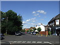
Residents of GU14 6PA benefit from nearby amenities that cater to daily needs. The area has five retail outlets, including Co-op Farnborough and Budgens 7Am / Aidan’s, offering convenience for grocery shopping. Rail stations like North Camp and Farnborough provide easy access to commuting, while nearby airports add to the area’s connectivity. Though the postcode itself is small, its proximity to these venues ensures a practical lifestyle. The mix of shops, transport hubs, and airports means residents can access essentials without long journeys, supporting a balanced routine of work, leisure, and family life.
Amenities
Schools
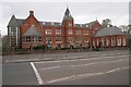
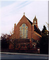
Residents of GU14 6PA have access to a mix of primary and independent schools. South Farnborough Infant School and St Mark’s Church of England Aided Primary School both hold Ofsted ratings of ‘good’, offering reliable state education for younger children. Salesian College, an independent school, provides an alternative for families seeking private education. This combination of school types ensures flexibility for parents, whether they prioritise affordability and accessibility or seek independent schooling. The presence of two well-rated primary schools suggests a strong focus on early education, while the independent option caters to those seeking alternative curricula or smaller class sizes.
| Rank | School | Type | Entry gender | Ages |
|---|
Explore more schools in this area
Go to Schools tabDemographics
GU14 6PA’s population skews towards adults aged 30–64, with a median age of 47. This suggests a community of established professionals and families, rather than students or retirees. Home ownership is high at 68%, indicating a stable, long-term resident base. The area is predominantly composed of houses, not flats, which aligns with the demographic’s preference for family-friendly housing. The predominant ethnic group is White, reflecting a homogenous population. The high population density—170,930 people per square kilometre—means living spaces are closely packed, which could impact privacy or outdoor space. However, this density also fosters a tight-knit community where local services and social networks are likely to be well-developed.
Household Size
Accommodation Type
Tenure
Ethnic Group
Religion
Household Composition
Age
Household Deprivation
NS-SEC
Explore more demographic insights in this area
Go to Demographics tabPlanning
Planning Constraints
- Flood RiskPremium
- Ramsar Wetland SitesPremium
- Area of Outstanding Natural BeautyPremium
- Protected Nature ReservePremium
- Protected WoodlandPremium