Area Overview for GU14 6NN
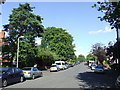
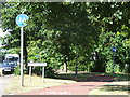
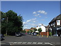
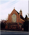
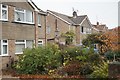
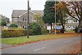
Photos of GU14 6NN


Area Information
GU14 6NN is a compact postcode area in England, covering just 3,229 square metres and home to 1,885 residents. Its high population density — 583,773 people per square kilometre — reflects its small, tightly packed residential character. This is a mature community, with a median age of 47 and the majority of residents aged between 30 and 64. The area is dominated by flats, with 62% of homes owner-occupied, suggesting a stable, long-term population. Daily life here is shaped by proximity to key infrastructure, including multiple rail stations and nearby airports, while the absence of major natural constraints means residents can navigate the area without environmental restrictions. The postcode’s small size means it is a self-contained hub, with amenities and services clustered closely. For those seeking a quiet, established residential environment with practical connectivity, GU14 6NN offers a focused, community-oriented lifestyle.
- Area Type
- Postcode
- Area Size
- 3229 m²
- Population
- 1885
- Population Density
- 1905 people/km²
GU14 6NN is a small area with a housing stock dominated by flats, reflecting its compact design and likely post-war or mid-century development. With 62% of homes owner-occupied, the market is primarily residential, though the proportion of renters is not specified. The high population density and limited area size suggest that property availability is constrained, making the area a niche market for buyers seeking flats in a mature, established postcode. The focus on flats may appeal to those prioritising convenience and proximity to services, though buyers should consider the lack of larger homes or detached properties. Given the area’s small footprint, property values and availability are likely influenced by proximity to nearby transport hubs and amenities, such as rail stations and retail centres.
House Prices in GU14 6NN
Showing 11 properties
| Address | Type | Beds | Baths | Last Sale Price | Last Sale Date | |
|---|---|---|---|---|---|---|
| 10 Canterbury Road, Farnborough, GU14 6NN | Terraced | 2 | 1 | £353,000 | Jan 2024 | |
| 20 Canterbury Road, Farnborough, GU14 6NN | Semi-detached | 3 | 1 | £460,000 | Jan 2024 | |
| 14 Canterbury Road, Farnborough, GU14 6NN | Semi-detached | 3 | 1 | £465,000 | Sep 2023 | |
| 22 Canterbury Road, Farnborough, GU14 6NN | Semi-detached | 3 | 1 | £440,500 | Jul 2019 | |
| 4 Canterbury Road, Farnborough, GU14 6NN | house | 2 | - | £195,000 | Sep 2012 | |
| 8 Canterbury Road, Farnborough, GU14 6NN | Terraced | 2 | 1 | £108,250 | Oct 2000 | |
| 6 Canterbury Road, Farnborough, GU14 6NN | Terraced | 2 | 1 | £53,000 | Apr 1995 | |
| 18 Canterbury Road, Farnborough, GU14 6NN | Semi-detached | 3 | 2 | - | - | |
| 16 Canterbury Road, Farnborough, GU14 6NN | Semi-detached | - | - | - | - | |
| 12 Canterbury Road, Farnborough, GU14 6NN | Semi-detached | - | - | - | - |
Energy Efficiency in GU14 6NN
GU14 6NN offers a range of practical amenities within easy reach. Retail options include Co-op Farnborough, Budgens 7Am / Aidan’s, and other local shops, providing everyday convenience. The proximity to rail stations — such as North Camp and Farnborough — ensures easy access to public transport, while nearby airports cater to those requiring air travel. Though the area lacks large parks or leisure facilities, its compact design means essential services are clustered closely. The presence of multiple retail outlets and transport links supports a lifestyle focused on accessibility and efficiency. Residents can enjoy a mix of local shopping and connectivity, though larger recreational spaces may require travel to adjacent towns.
Amenities
Schools
The nearest educational institution to GU14 6NN is Farnborough College of Technology, a sixth-form college offering post-16 education. No primary or secondary schools are listed in the data, meaning families with younger children may need to look beyond the immediate area for schooling. The presence of a sixth-form college suggests the area is well-served for higher education, particularly for students pursuing vocational or academic pathways. However, the absence of local schools for younger age groups could be a consideration for families prioritising proximity to education. Residents may need to rely on nearby towns or transport links to access a broader range of schooling options.
| Rank | School | Type | Entry gender | Ages |
|---|
Explore more schools in this area
Go to Schools tabDemographics
The population of GU14 6NN is predominantly adults aged 30 to 64, with a median age of 47. This suggests a settled community with a strong presence of middle-aged residents, likely including professionals and families. Home ownership is high, at 62%, indicating a mix of long-term residents and those with a financial stake in the area. The accommodation type is primarily flats, which may reflect the area’s compact nature and historical development. The predominant ethnic group is White, though no specific diversity statistics are provided. The high population density — 583,773 people per square kilometre — implies a tightly packed residential layout, which may influence local services and social dynamics. While no deprivation data is available, the demographic profile suggests a stable, middle-income community with access to essential amenities.
Household Size
Accommodation Type
Tenure
Ethnic Group
Religion
Household Composition
Age
Household Deprivation
NS-SEC
Explore more demographic insights in this area
Go to Demographics tabPlanning
Planning Constraints
- Flood RiskPremium
- Ramsar Wetland SitesPremium
- Area of Outstanding Natural BeautyPremium
- Protected Nature ReservePremium
- Protected WoodlandPremium