Area Overview for GU12 4RW
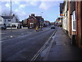
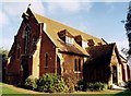
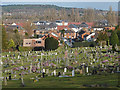
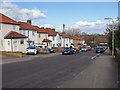
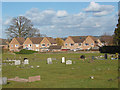
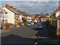
Photos of GU12 4RW


Area Information
Living in GU12 4RW offers a compact, densely populated residential environment within a small cluster of just 1.9 hectares. With 2,494 residents, the area is characterised by a high population density of 130,349 people per square kilometre, reflecting a tightly knit community. The demographic profile shows a median age of 47, with adults aged 30–64 forming the largest group. This suggests a stable, established population, likely with families and professionals. Daily life here is shaped by proximity to essential services, including five retail outlets like Co-op Aldershot and Sainsburys Aldershot, and five railway stations, including Aldershot and Ash Vale. The area’s small size means residents are within practical reach of amenities, though its limited space may influence housing availability. For those prioritising convenience and connectivity, GU12 4RW balances accessibility with the constraints of its size, offering a mix of local shops, transport links, and proximity to Farnborough Airport. However, the high density may impact privacy and outdoor space, which potential buyers should consider.
- Area Type
- Postcode
- Area Size
- 1.9 hectares
- Population
- 2494
- Population Density
- 4422 people/km²
The property market in GU12 4RW is defined by a 51% home ownership rate, suggesting a balanced mix of owner-occupied homes and rental properties. The accommodation type is predominantly houses, which, given the area’s small size of 1.9 hectares, likely means a limited number of larger properties. This contrasts with areas where flats or apartments dominate, and may appeal to buyers seeking traditional housing. However, the high population density of 130,349 people per square kilometre indicates that housing stock is constrained, potentially driving competition for available properties. For buyers, this means the immediate area may offer few options, requiring consideration of nearby regions. The presence of five railway stations, including Aldershot, suggests strong transport links, which could enhance the area’s appeal for commuters. However, the small footprint of GU12 4RW means properties here may be more expensive relative to their size, necessitating careful evaluation of value and long-term viability.
House Prices in GU12 4RW
Showing 16 properties
| Address | Type | Beds | Baths | Last Sale Price | Last Sale Date | |
|---|---|---|---|---|---|---|
| 10 Clarence Close, Aldershot, GU12 4RW | house | - | - | £288,500 | Aug 2021 | |
| 8 Clarence Close, Aldershot, GU12 4RW | Terraced | 3 | 1 | £293,000 | Jul 2021 | |
| 1 Clarence Close, Aldershot, GU12 4RW | Semi-detached | 3 | - | £310,000 | Mar 2021 | |
| 15 Clarence Close, Aldershot, GU12 4RW | house | 3 | - | £295,000 | Dec 2020 | |
| 3 Clarence Close, Aldershot, GU12 4RW | Terraced | 3 | 1 | £318,000 | Jul 2020 | |
| 16 Clarence Close, Aldershot, GU12 4RW | Terraced | - | - | £210,000 | May 2007 | |
| 5 Clarence Close, Aldershot, GU12 4RW | Terraced | - | - | £175,000 | Nov 2005 | |
| 12 Clarence Close, Aldershot, GU12 4RW | Terraced | - | - | £87,000 | Nov 1998 | |
| 14 Clarence Close, Aldershot, GU12 4RW | Terraced | - | - | £82,000 | Sep 1998 | |
| 6 Clarence Close, Aldershot, GU12 4RW | Terraced | - | - | - | - |
Energy Efficiency in GU12 4RW
The lifestyle in GU12 4RW is shaped by its proximity to a range of amenities, including five retail outlets such as Co-op Aldershot, Sainsburys Aldershot, and Lidl Central. These shops provide everyday essentials, reducing the need for long trips to larger centres. The area’s railway stations, including Aldershot and Ash Vale, offer convenient access to regional transport, while Farnborough Airport is within reach for those requiring air travel. Though the data does not mention parks or leisure facilities, the high population density suggests that outdoor space may be limited, potentially requiring residents to seek recreational options in nearby areas. The compact nature of the area means that daily life is centred around local services, fostering a sense of community. However, buyers should consider whether the lifestyle aligns with their preferences for space, privacy, and access to larger green areas.
Amenities
Schools
Residents of GU12 4RW have access to two primary schools: Alderwood School, rated ‘good’ by Ofsted, and Belle Vue County Infant School. Both cater to younger children, providing a range of primary education options for families. Alderwood School’s ‘good’ rating indicates a satisfactory standard of teaching and facilities, while Belle Vue County Infant School serves the early years of primary education. The presence of two primary schools within reach suggests a focus on local education, reducing the need for long commutes. However, the data does not include secondary schools or further education institutions, which may require residents to travel to nearby towns. For families prioritising proximity to schools, this area offers immediate access to primary education, though secondary schooling options would need to be considered separately.
| Rank | School | Type | Entry gender | Ages |
|---|
Explore more schools in this area
Go to Schools tabDemographics
The community in GU12 4RW is predominantly composed of adults aged 30–64, with a median age of 47. This suggests a mature, settled population, likely with established careers and families. Home ownership rates stand at 51%, indicating a mix of owner-occupied properties and rental units. The accommodation type is primarily houses, which, combined with the high population density, implies smaller dwellings or shared spaces. The predominant ethnic group is White, with no specific data on other demographics provided. The population density of 130,349 people per square kilometre is exceptionally high, comparable to urban centres, which may influence living conditions, such as limited green space or higher demand for housing. While this density ensures proximity to services, it also means residents may experience a more compact, possibly busier lifestyle. The data does not indicate deprivation levels, but such high density often correlates with higher housing costs and potential pressure on local infrastructure.
Household Size
Accommodation Type
Tenure
Ethnic Group
Religion
Household Composition
Age
Household Deprivation
NS-SEC
Explore more demographic insights in this area
Go to Demographics tabPlanning
Planning Constraints
- Flood RiskPremium
- Ramsar Wetland SitesPremium
- Area of Outstanding Natural BeautyPremium
- Protected Nature ReservePremium
- Protected WoodlandPremium