Area Overview for GU12 4HE
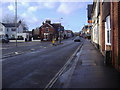
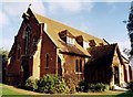
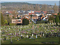
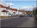
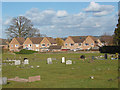
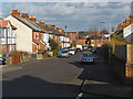
Photos of GU12 4HE


Area Information
Living in GU12 4HE means inhabiting a tightly packed residential cluster in England, where 2,494 people reside across just 1.9 hectares. This density creates a compact, closely knit community, with homes primarily in single-family structures. The area’s proximity to Aldershot and its surrounding infrastructure makes it a practical choice for those seeking a balance between suburban living and accessibility. Daily life here is shaped by the presence of nearby primary schools, rail links, and retail hubs, ensuring essentials are within reach. With a median age of 47 and a population skewed toward adults aged 30–64, the area feels settled and family-oriented. While the small size means limited expansion, it also fosters a sense of familiarity. Residents benefit from excellent broadband connectivity and proximity to Aldershot’s transport network, making it a viable option for commuters or those prioritising convenience over sprawling landscapes.
- Area Type
- Postcode
- Area Size
- 1.9 hectares
- Population
- 2494
- Population Density
- 4422 people/km²
The property market in GU12 4HE is defined by a 51% home ownership rate, with houses making up the primary accommodation type. This suggests a community where owner-occupation is common, though rental options also exist. Given the area’s small size—just 1.9 hectares—housing stock is limited, and the market likely operates within a tight radius of Aldershot. Buyers should consider the compact nature of the area, which may mean limited availability of new builds or larger properties. The predominance of houses implies a focus on family homes, though the high population density could mean smaller, more efficient properties. For those seeking a quiet, established neighbourhood with proximity to schools and transport, this area offers a blend of practicality and stability.
House Prices in GU12 4HE
Showing 25 properties
| Address | Type | Beds | Baths | Last Sale Price | Last Sale Date | |
|---|---|---|---|---|---|---|
| 18 Westbury Way, Aldershot, GU12 4HE | Terraced | 3 | 2 | £390,000 | Apr 2024 | |
| 6 Westbury Way, Aldershot, GU12 4HE | Semi-detached | 3 | 1 | £370,000 | Aug 2023 | |
| 11 Westbury Way, Aldershot, GU12 4HE | Terraced | 4 | 3 | £445,000 | Jul 2022 | |
| 22 Westbury Way, Aldershot, GU12 4HE | house | 3 | 2 | £405,000 | May 2022 | |
| 4 Westbury Way, Aldershot, GU12 4HE | house | - | - | £344,000 | Mar 2021 | |
| 12 Westbury Way, Aldershot, GU12 4HE | Terraced | 2 | 1 | £270,000 | Mar 2020 | |
| 3 Westbury Way, Aldershot, GU12 4HE | Semi-detached | 3 | 1 | £327,000 | Feb 2020 | |
| 13 Westbury Way, Aldershot, GU12 4HE | house | - | - | £260,000 | Nov 2018 | |
| 23 Westbury Way, Aldershot, GU12 4HE | Semi-detached | 3 | - | £320,000 | Oct 2017 | |
| 19 Westbury Way, Aldershot, GU12 4HE | house | 3 | - | £229,950 | Oct 2010 |
Energy Efficiency in GU12 4HE
GU12 4HE’s lifestyle is shaped by its proximity to essential amenities. Retail options include major chains like Co-op Aldershot, Sainsburys Aldershot, and Lidl Central, ensuring everyday shopping needs are met. The area’s rail stations—Aldershot, Ash, and Ash Vale—provide easy access to broader networks, while Farnborough Airport offers regional travel. Though the data does not mention parks or leisure facilities explicitly, the high population density and compact layout suggest shared community spaces are likely. For residents, the mix of retail, transport, and nearby schools creates a convenient, self-contained environment. The area’s character is defined by practicality, with amenities designed to serve daily life efficiently.
Amenities
Schools
Residents of GU12 4HE have access to two primary schools: Alderwood School, which holds a ‘good’ Ofsted rating, and Belle Vue County Infant School. Both institutions cater to younger children, providing a foundation for local families. The presence of two primary schools within practical reach suggests a focus on early education, though no secondary schools are listed in the data. For parents, this means immediate access to schooling for young children, reducing the need for long commutes. The ‘good’ rating at Alderwood indicates a reliable standard of education, while Belle Vue’s absence of an Ofsted rating may prompt further inquiry. Families prioritising primary education will find this area well served, though secondary schooling options would require looking beyond the immediate vicinity.
| Rank | School | Type | Entry gender | Ages |
|---|
Explore more schools in this area
Go to Schools tabDemographics
GU12 4HE has a median age of 47, with the majority of residents aged between 30 and 64. This suggests a mature, stable population, likely with established careers and families. Home ownership sits at 51%, indicating a mix of owner-occupied properties and rental units. The accommodation type is predominantly houses, reflecting a traditional residential layout. The predominant ethnic group is White, though no specific data on diversity or deprivation is provided. The population density of 133,064 people per square kilometre is exceptionally high, which may influence the character of the area, with homes closely spaced and shared community spaces likely. For buyers, this density means a tightly woven neighbourhood where proximity to amenities and neighbours is a given, though it also limits scope for new development.
Household Size
Accommodation Type
Tenure
Ethnic Group
Religion
Household Composition
Age
Household Deprivation
NS-SEC
Explore more demographic insights in this area
Go to Demographics tabPlanning
Planning Constraints
- Flood RiskPremium
- Ramsar Wetland SitesPremium
- Area of Outstanding Natural BeautyPremium
- Protected Nature ReservePremium
- Protected WoodlandPremium