Area Overview for GU12 4RR
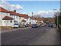
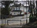
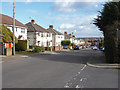
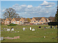
Photos of GU12 4RR


Area Information
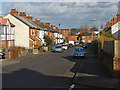
Living in GU12 4RR offers a compact, residential experience within a small cluster of homes. The area covers 1.2 hectares and is home to 2,494 residents, creating a densely populated yet intimate community. Situated in England, this postcode is part of a broader network of nearby towns and villages, with Aldershot and surrounding areas within practical reach. Daily life here is shaped by proximity to essential services, including retail, transport hubs, and educational institutions. The area’s small size means residents often know their neighbours, fostering a close-knit environment. While the population density is high at 203,651 people per square kilometre, the community remains focused on local amenities and connectivity. For those seeking a balance between urban convenience and residential tranquillity, GU12 4RR provides access to nearby shopping, transport, and natural spaces without the sprawl of larger towns. The area’s character is defined by its practicality, with homes primarily occupied by owner-occupiers and a median age of 47 suggesting a stable, established population.
- Area Type
- Postcode
- Area Size
- 1.2 hectares
- Population
- 2494
- Population Density
- 4422 people/km²
The property market in GU12 4RR is characterised by a 51% home ownership rate, indicating that nearly half of the properties are owner-occupied. The accommodation type is predominantly houses, which suggests a residential area with larger, more traditional homes rather than apartments or flats. This mix implies a market skewed towards owner-occupiers seeking family-friendly housing, rather than a high-rental environment. Given the area’s small size and limited housing stock, the market is likely competitive, with buyers needing to consider proximity to amenities and transport links. The presence of nearby retail, schools, and rail networks adds to the appeal, though the compact nature of the area means property choices are constrained. For buyers, this small postcode offers a blend of stability and convenience, though the limited size may require looking beyond immediate surroundings for additional options.
House Prices in GU12 4RR
Showing 28 properties
| Address | Type | Beds | Baths | Last Sale Price | Last Sale Date | |
|---|---|---|---|---|---|---|
| 55 Connaught Road, Aldershot, GU12 4RR | Detached | 3 | 1 | £380,000 | Sep 2025 | |
| 58 Connaught Road, Aldershot, GU12 4RR | Semi-detached | 3 | 1 | £415,000 | Aug 2025 | |
| 60 Connaught Road, Aldershot, GU12 4RR | Semi-detached | 3 | 1 | £348,000 | Oct 2024 | |
| 62 Connaught Road, Aldershot, GU12 4RR | Semi-detached | 3 | 1 | £312,500 | Aug 2024 | |
| 61 Connaught Road, Aldershot, GU12 4RR | house | 3 | 2 | £345,000 | Apr 2024 | |
| 74 Connaught Road, Aldershot, GU12 4RR | Semi-detached | 3 | 2 | £370,000 | Jan 2024 | |
| 67 Connaught Road, Aldershot, GU12 4RR | Terraced | 2 | 1 | £286,000 | Feb 2022 | |
| 86 Connaught Road, Aldershot, GU12 4RR | house | - | - | £365,000 | Dec 2021 | |
| 75 Connaught Road, Aldershot, GU12 4RR | Detached | 3 | 2 | £400,000 | Jan 2021 | |
| 56 Connaught Road, Aldershot, GU12 4RR | house | - | - | £315,000 | Dec 2020 |
Energy Efficiency in GU12 4RR
Residents of GU12 4RR have access to a range of nearby amenities that support daily life. Retail options include Co-op Aldershot, Sainsburys Aldershot, and Lidl Central, providing essential shopping and grocery needs. These stores are strategically located, making it easy to access food, household items, and other necessities. The area’s proximity to rail stations and Farnborough Airport enhances mobility, allowing residents to travel efficiently for work, leisure, or travel. While the data does not specify parks or leisure facilities, the presence of multiple retail and transport hubs suggests a practical, convenience-focused lifestyle. The compact nature of the area means amenities are concentrated, reducing the need for long commutes. For those prioritising accessibility and ease of access to services, GU12 4RR offers a well-connected, functional environment.
Amenities
Schools
Residents of GU12 4RR have access to two primary schools within practical reach: Alderwood School, which holds a ‘good’ Ofsted rating, and Belle Vue County Infant School. Both institutions cater to younger children, providing a foundation for early education. The presence of two primary schools suggests a focus on family-friendly infrastructure, though no secondary schools are listed in the data. For families with children, this mix of schools offers options for early education but may necessitate travel for secondary schooling. The Ofsted rating at Alderwood School indicates a standard of teaching that meets expectations, which is reassuring for parents prioritising quality education. However, the absence of data on school capacity, catchment areas, or performance metrics means further research would be needed to assess suitability for individual needs.
| Rank | School | Type | Entry gender | Ages |
|---|
Explore more schools in this area
Go to Schools tabDemographics
The community in GU12 4RR is predominantly composed of adults aged 30–64, with a median age of 47. This suggests a mature, settled population, likely with long-term ties to the area. Home ownership rates stand at 51%, indicating a mix of owner-occupied properties and rental homes. The primary accommodation type is houses, reflecting a residential focus rather than high-density housing. The predominant ethnic group is White, which aligns with broader demographic trends in the region. While no specific data on deprivation or diversity is provided, the age profile and home ownership figures suggest a stable, middle-aged population with established family units. The absence of detailed diversity metrics means the community’s full composition remains partially unexplored, but the figures available highlight a focus on long-term residency and family-oriented living.
Household Size
Accommodation Type
Tenure
Ethnic Group
Religion
Household Composition
Age
Household Deprivation
NS-SEC
Explore more demographic insights in this area
Go to Demographics tabPlanning
Planning Constraints
- Flood RiskPremium
- Ramsar Wetland SitesPremium
- Area of Outstanding Natural BeautyPremium
- Protected Nature ReservePremium
- Protected WoodlandPremium