Area Overview for GU12 4DB
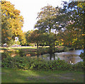
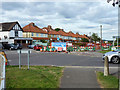
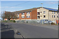
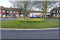
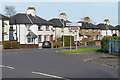
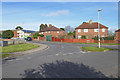
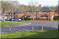
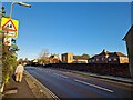
Photos of GU12 4DB


Area Information
GU12 4DB is a small residential cluster in England, covering 8,563 square metres and home to 1,586 residents. Its population density of 185,225 people per square kilometre reflects a compact, closely knit community. The area is characterised by a mature demographic, with a median age of 47 and most residents falling within the 30-64 age range. This suggests a stable, long-term population, likely centred around family homes and local amenities. Daily life here is shaped by proximity to essential services, including multiple retail outlets, railway stations, and a nearby airport. The area’s small size means residents are likely to know their neighbours, fostering a sense of familiarity. With 76% of homes owned outright, the community leans towards homeownership, reinforcing a sense of permanence. The absence of major environmental constraints or planning restrictions allows for straightforward living, while the low crime risk adds to its appeal. For those seeking a quiet, established neighbourhood with practical connectivity, GU12 4DB offers a blend of convenience and tranquillity.
- Area Type
- Postcode
- Area Size
- 8563 m²
- Population
- 1586
- Population Density
- 5353 people/km²
The property market in GU12 4DB is dominated by owner-occupied homes, with 76% of properties owned outright. This high rate of homeownership suggests a community of long-term residents rather than a rental market. The accommodation type is predominantly houses, which is unusual for areas with higher flat or apartment density. This indicates a focus on single-family homes, likely appealing to families or individuals seeking space and privacy. Given the area’s small size and limited housing stock, the market is likely to be competitive for buyers, with limited scope for new developments. The compact nature of the area means that properties are likely to be in close proximity to local amenities, enhancing their practicality. For buyers, this suggests a need to act swiftly, as the limited supply may mean fewer opportunities for those seeking to move into the area.
House Prices in GU12 4DB
Showing 33 properties
| Address | Type | Beds | Baths | Last Sale Price | Last Sale Date | |
|---|---|---|---|---|---|---|
| 169 Ash Road, Aldershot, GU12 4DB | Retail | 2 | 1 | £142,500 | Jul 2023 | |
| 175 Ash Road, Aldershot, GU12 4DB | Maisonette | 2 | 1 | £185,000 | Jun 2023 | |
| 147 Ash Road, Aldershot, GU12 4DB | Semi-detached | 3 | 1 | £320,000 | Mar 2023 | |
| 135 Ash Road, Aldershot, GU12 4DB | Flat | - | - | £120,000 | Jul 2022 | |
| 141 Ash Road, Aldershot, GU12 4DB | Terraced | 2 | 1 | £280,000 | Apr 2019 | |
| 131 Ash Road, Aldershot, GU12 4DB | Maisonette | 1 | - | £166,000 | Jun 2018 | |
| 159A Ash Road, Aldershot, GU12 4DB | Flat | - | - | £685,000 | Jun 2017 | |
| 137 Ash Road, Aldershot, GU12 4DB | Flat | 1 | - | £130,000 | Oct 2015 | |
| 171 Ash Road, Aldershot, GU12 4DB | Maisonette | 3 | - | £127,000 | Jul 2015 | |
| 173 Ash Road, Aldershot, GU12 4DB | Flat | 2 | 1 | £164,950 | Jan 2015 |
Energy Efficiency in GU12 4DB
The lifestyle in GU12 4DB is shaped by its proximity to essential amenities. Retail options include Sainsburys Aldershot, The Southern Co-operative Co, and Co-op Aldershot, providing access to groceries and daily necessities. These shops are likely to serve the local population efficiently, reducing the need for long trips to larger centres. The railway stations nearby—Aldershot, Ash, and Ash Vale—enhance mobility, connecting residents to broader networks. While the area lacks detailed data on parks or leisure facilities, the presence of multiple retail and transport hubs suggests a focus on convenience. The character of the area is defined by its practicality, with amenities arranged to meet the needs of a mature, homeownership-oriented community. For residents, this means a lifestyle that prioritises accessibility and ease of access to services.
Amenities
Schools
Residents of GU12 4DB have access to three primary schools: Newport Junior School, Newport County Junior School, and Newport County Infant School. These institutions cater to early education, with a mix of infant and junior levels to support families with children of varying ages. The presence of multiple primary schools within the area ensures that families have options for their children’s education, reducing the need for long commutes. The schools’ types suggest a focus on foundational learning, with infant schools for younger children and junior schools for older primary students. While no Ofsted ratings are provided, the diversity of school types indicates a range of educational approaches available to parents. For families prioritising proximity to schools, this cluster of primary institutions is a significant advantage.
| Rank | School | Type | Entry gender | Ages |
|---|
Explore more schools in this area
Go to Schools tabDemographics
The community in GU12 4DB is predominantly composed of adults aged 30-64, with a median age of 47. This indicates a mature population, likely with established careers and families. Home ownership is high at 76%, suggesting a stable housing market with long-term residents. The area is primarily composed of houses, reflecting a preference for single-family dwellings over flats or apartments. The predominant ethnic group is White, though no specific data on diversity or deprivation is provided. The high home ownership rate and age profile suggest a community focused on stability and long-term residence. With no evidence of significant deprivation, the area likely supports a quality of life that aligns with the needs of its residents. The absence of younger demographics or student populations further reinforces the area’s role as a settled, family-oriented neighbourhood.
Household Size
Accommodation Type
Tenure
Ethnic Group
Religion
Household Composition
Age
Household Deprivation
NS-SEC
Explore more demographic insights in this area
Go to Demographics tabPlanning
Planning Constraints
- Flood RiskPremium
- Ramsar Wetland SitesPremium
- Area of Outstanding Natural BeautyPremium
- Protected Nature ReservePremium
- Protected WoodlandPremium