Area Overview for GU12 4QD
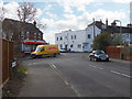
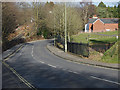
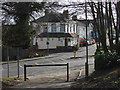
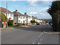
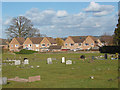
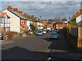
Photos of GU12 4QD


Area Information
GU12 4QD is a compact residential postcode in England, covering just 5,868 square metres and home to 1,586 residents. Its high population density—270,276 people per square kilometre—reflects a tightly knit community where proximity to amenities and services is a defining feature. The area’s character is shaped by its small-scale layout, with homes predominantly in private ownership. Daily life here is influenced by its strategic location, offering access to nearby retail, transport hubs, and educational facilities. With a median age of 47 and a population skewed toward adults aged 30–64, the community is stable and family-oriented. The presence of multiple primary schools and nearby railway stations suggests a balance between local convenience and broader connectivity. While the area is small, its infrastructure supports a practical lifestyle, blending residential comfort with essential services. For buyers, GU12 4QD offers a snapshot of a mature, established neighbourhood with clear advantages in accessibility and safety.
- Area Type
- Postcode
- Area Size
- 5868 m²
- Population
- 1586
- Population Density
- 5353 people/km²
GU12 4QD is primarily an owner-occupied area, with 76% of homes in private hands. The accommodation type is predominantly houses, which is unusual for a small postcode but may reflect a focus on family homes in a compact layout. This suggests a market where properties are likely to be long-term investments rather than short-term rentals. The high home ownership rate indicates a stable demand for residential property, though the limited area size means the housing stock is constrained. Buyers should consider the proximity to essential services, including schools and transport links, which add value to the area. The presence of multiple primary schools and nearby railway stations enhances the appeal for families, making GU12 4QD a practical choice for those prioritising convenience over expansive living space.
House Prices in GU12 4QD
Showing 18 properties
| Address | Type | Beds | Baths | Last Sale Price | Last Sale Date | |
|---|---|---|---|---|---|---|
| 22 Lower Newport Road, Aldershot, GU12 4QD | Semi-detached | 3 | 1 | £370,000 | May 2022 | |
| 4 Lower Newport Road, Aldershot, GU12 4QD | Semi-detached | 3 | - | £302,000 | Jul 2019 | |
| 10 Lower Newport Road, Aldershot, GU12 4QD | Semi-detached | 3 | 1 | £315,000 | Jun 2017 | |
| 2 Lower Newport Road, Aldershot, GU12 4QD | Semi-detached | 3 | 2 | £322,000 | Oct 2016 | |
| 16 Lower Newport Road, Aldershot, GU12 4QD | house | - | - | £240,000 | Mar 2015 | |
| 24 Lower Newport Road, Aldershot, GU12 4QD | house | - | - | £184,000 | Aug 2010 | |
| 8 Lower Newport Road, Aldershot, GU12 4QD | house | - | - | £207,000 | Sep 2009 | |
| 12 Lower Newport Road, Aldershot, GU12 4QD | house | - | - | £135,000 | Apr 2009 | |
| 6 Lower Newport Road, Aldershot, GU12 4QD | Semi-detached | 3 | 1 | £127,000 | May 2002 | |
| 30 Lower Newport Road, Aldershot, GU12 4QD | house | - | - | £66,000 | May 1996 |
Energy Efficiency in GU12 4QD
The lifestyle in GU12 4QD is shaped by its proximity to essential amenities. Residents have access to five retail outlets, including Sainsburys Aldershot and The Southern Co-operative Co, ensuring daily shopping needs are met locally. The area’s rail network, with stations such as Aldershot and Ash Vale, provides easy access to commuting routes and regional hubs. Farnborough Airport is also nearby, offering additional travel options. While the area is small, its amenities are practical and well-integrated into daily life. The presence of multiple schools, shops, and transport links creates a self-contained environment, reducing the need for long journeys. This balance of convenience and accessibility supports a lifestyle that prioritises efficiency without sacrificing the comfort of a residential community.
Amenities
Schools
Residents of GU12 4QD have access to three primary schools: Newport Junior School, Newport County Junior School, and Newport County Infant School. These institutions cater to younger children, providing a range of options for families. The concentration of primary schools in the area suggests a focus on local education, reducing the need for long commutes to secondary schools. While no Ofsted ratings are provided, the presence of multiple schools indicates a commitment to education within the community. For families, this proximity to schooling is a key advantage, supporting a lifestyle where children can attend local institutions without significant travel. The mix of infant and junior schools ensures coverage for early years through primary education, which is essential for parents seeking a cohesive educational environment.
| Rank | School | Type | Entry gender | Ages |
|---|
Explore more schools in this area
Go to Schools tabDemographics
The population of GU12 4QD is predominantly adults aged 30–64, with a median age of 47. This suggests a community rooted in middle-aged households, likely with established careers and families. Home ownership is high at 76%, indicating a stable residential base with long-term residents. The area is composed mostly of houses rather than flats, which aligns with the demographics of a mature, family-focused population. The predominant ethnic group is White, reflecting a homogenous community. The high population density—270,276 people per square kilometre—means living spaces are closely packed, which could influence the character of the area, fostering a sense of familiarity among residents. While no specific data on deprivation is provided, the low crime risk and safety score of 72 suggest a relatively secure environment, which may contribute to the area’s appeal for families seeking stability.
Household Size
Accommodation Type
Tenure
Ethnic Group
Religion
Household Composition
Age
Household Deprivation
NS-SEC
Explore more demographic insights in this area
Go to Demographics tabPlanning
Planning Constraints
- Flood RiskPremium
- Ramsar Wetland SitesPremium
- Area of Outstanding Natural BeautyPremium
- Protected Nature ReservePremium
- Protected WoodlandPremium