Area Overview for GU12 4BZ
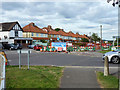
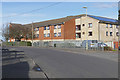
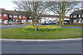
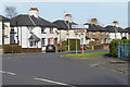
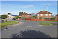
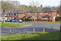
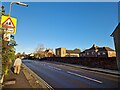
Photos of GU12 4BZ


Area Information
Living in GU12 4BZ offers a compact, residential experience shaped by its small area size of 5,008 square metres and a population of 1,586 people. The high population density of 316,674 people per square kilometre reflects a tightly knit community, ideal for those seeking proximity to amenities without sacrificing space. The area’s character is defined by its predominantly owner-occupied housing stock, with 76% of homes owned by residents. This suggests a stable, long-term community, with many residents likely to have lived in the area for years. The presence of three primary schools—Newport Junior School, Newport County Junior School, and Newport County Infant School—cater to local families, while nearby retail hubs like Sainsburys Aldershot and rail stations such as Aldershot Railway Station provide practical connectivity. With low flood risk and a crime score of 72 (below average), the area balances safety with access to essential services, making it appealing for those prioritising security and convenience.
- Area Type
- Postcode
- Area Size
- 5008 m²
- Population
- 1586
- Population Density
- 5353 people/km²
The property market in GU12 4BZ is characterised by a strong emphasis on owner-occupation, with 76% of homes owned by residents. This contrasts with areas where rental properties dominate, suggesting a community of long-term residents rather than a transient population. The accommodation type is primarily houses, which is typical for smaller residential areas where larger properties are more common. This housing stock may appeal to families or individuals seeking more space than a flat could offer. However, the area’s small size means the housing stock is limited, and buyers may need to consider nearby zones for more options. The high home ownership rate also implies a stable market, with fewer properties available for sale or rent, which could influence pricing and availability.
House Prices in GU12 4BZ
Showing 29 properties
| Address | Type | Beds | Baths | Last Sale Price | Last Sale Date | |
|---|---|---|---|---|---|---|
| 115 Ash Road, Aldershot, GU12 4BZ | Detached | 3 | 3 | £415,000 | Dec 2025 | |
| 95 Ash Road, Aldershot, GU12 4BZ | Terraced | 3 | 1 | £325,000 | Feb 2024 | |
| 87 Ash Road, Aldershot, GU12 4BZ | Maisonette | 2 | 1 | £210,000 | Oct 2023 | |
| 103 Ash Road, Aldershot, GU12 4BZ | Terraced | 3 | 1 | £280,000 | Mar 2023 | |
| 81 Ash Road, Aldershot, GU12 4BZ | Maisonette | 2 | 1 | £185,500 | Jan 2023 | |
| 85 Ash Road, Aldershot, GU12 4BZ | Terraced | 4 | 2 | £400,000 | Dec 2022 | |
| 89 Ash Road, Aldershot, GU12 4BZ | Terraced | 2 | 1 | £300,000 | Nov 2022 | |
| 113 Ash Road, Aldershot, GU12 4BZ | Terraced | 2 | - | £297,000 | Oct 2021 | |
| 127 Ash Road, Aldershot, GU12 4BZ | Semi-detached | 3 | 1 | £240,000 | Oct 2020 | |
| 93 Ash Road, Aldershot, GU12 4BZ | Terraced | 3 | 1 | £265,000 | Apr 2020 |
Energy Efficiency in GU12 4BZ
The lifestyle in GU12 4BZ is supported by a range of nearby amenities, including five retail outlets such as Sainsburys Aldershot and The Southern Co-operative Co. These shops provide essential grocery and daily needs, reducing the need for long trips to larger centres. The proximity to rail stations like Aldershot Railway Station and Ash Vale Railway Station enhances mobility, while Farnborough Airport offers additional travel options. Although the area is small, its amenities are strategically placed for convenience, allowing residents to access shopping, transport, and travel facilities without significant effort. The presence of multiple retail options and transport links contributes to a practical, community-focused lifestyle, ideal for those valuing accessibility and ease of movement.
Amenities
Schools
GU12 4BZ is served by three primary schools: Newport Junior School, Newport County Junior School, and Newport County Infant School. These institutions cater to younger children, providing a range of educational options for families with school-age dependents. The presence of multiple primary schools suggests a focus on early education, which is crucial for young families. While no Ofsted ratings are provided, the density of primary schools indicates a community prioritising accessible education for children. This clustering of schools may reduce the need for long commutes, allowing parents to balance work and family responsibilities more effectively. For those seeking a family-friendly environment, the proximity to these schools is a significant advantage.
| Rank | School | Type | Entry gender | Ages |
|---|
Explore more schools in this area
Go to Schools tabDemographics
The demographic profile of GU12 4BZ is marked by a median age of 47, with the majority of residents falling within the 30-64 age range. This suggests a community of established adults, many of whom may be in their prime working years or nearing retirement. Home ownership is high, at 76%, indicating a preference for long-term residency over rental properties. The area is predominantly composed of houses, rather than flats or apartments, which aligns with the typical housing stock in smaller, residential clusters. The predominant ethnic group is White, reflecting a homogenous demographic. While no specific data on deprivation or diversity is provided, the high home ownership rate and age profile suggest a relatively stable, middle-income community with fewer transient residents.
Household Size
Accommodation Type
Tenure
Ethnic Group
Religion
Household Composition
Age
Household Deprivation
NS-SEC
Explore more demographic insights in this area
Go to Demographics tabPlanning
Planning Constraints
- Flood RiskPremium
- Ramsar Wetland SitesPremium
- Area of Outstanding Natural BeautyPremium
- Protected Nature ReservePremium
- Protected WoodlandPremium