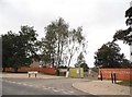
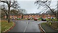
Area Overview for GU11 4FP
Photos of GU11 4FP


Area Information
GU11 4FP is a small, tightly knit residential postcode area in England, covering just 3,196 square metres and home to 2,169 residents. Its compact size means the community feels close-knit, with a population density of 929 people per square kilometre. This area is ideal for those seeking a balance between urban convenience and quiet living, with easy access to nearby towns and transport links. The median age of 22 suggests a mix of younger professionals and families, though the most common age range is adults aged 30–64. Daily life here is shaped by proximity to essential services, including multiple retail outlets and rail stations. The area’s small footprint means it is likely surrounded by larger towns or villages, offering a range of amenities within reach. For buyers, GU11 4FP represents a practical choice for those prioritising accessibility over expansive space, with homes typically located in traditional housing stock. Its position near Aldershot and Farnborough Airport adds to its appeal for commuters and those needing regular travel.
- Area Type
- Postcode
- Area Size
- 3196 m²
- Population
- 2169
- Population Density
- 929 people/km²
The property market in GU11 4FP is dominated by owner-occupied homes, though home ownership is relatively low at 18%. This suggests a rental market may be more prominent, with many properties likely rented out to tenants. The accommodation type is primarily houses, which are typical for small residential clusters. Given the area’s compact size and proximity to larger towns, it is likely that buyers seeking properties here are looking for a base near transport links or employment hubs. The low home ownership rate could indicate a transient population or a focus on rental investments. For those considering purchasing, the limited housing stock means competition may be higher, and properties are likely to be in traditional styles. The area’s small footprint also means buyers should consider nearby regions for more extensive housing options.
House Prices in GU11 4FP
Showing 20 properties
Energy Efficiency in GU11 4FP
Living in GU11 4FP offers access to a range of practical amenities within reach. The area is served by five retail outlets, including Lidl Central, Co-op Aldershot, and Iceland Aldershot, providing everyday shopping convenience. For transport, five rail stations—Aldershot, North Camp, and Ash Vale—offer frequent services to nearby towns and cities, while Farnborough Airport is a short distance away, catering to those needing air travel. Though the data does not mention parks or leisure facilities, the proximity to rail links suggests access to larger recreational areas in surrounding towns. The presence of multiple retail and transport hubs indicates a lifestyle focused on accessibility and practicality. Residents can enjoy a mix of local shopping and efficient travel options, making daily life in GU11 4FP both functional and connected.
Amenities
Schools
| Rank | School | Type | Entry gender | Ages |
|---|
Explore more schools in this area
Go to Schools tabDemographics
The community in GU11 4FP is predominantly composed of adults aged 30–64, with a median age of 22. This suggests a mix of younger professionals and established families, though the data indicates a higher proportion of middle-aged residents. Home ownership is relatively low at 18%, implying that many residents rent their properties. The area is characterised by houses rather than flats or apartments, which aligns with the residential cluster description. The predominant ethnic group is White, reflecting the broader demographic patterns of the region. With a population density of 929 people per square kilometre, the area is moderately populated, offering a balance between urban and suburban living. The absence of specific deprivation data means the quality of life can be inferred from the availability of amenities and services, which appear sufficient for daily needs.
Household Size
Accommodation Type
Tenure
Ethnic Group
Religion
Household Composition
Age
Household Deprivation
NS-SEC
Explore more demographic insights in this area
Go to Demographics tabPlanning
Planning Constraints
- Flood RiskPremium
- Ramsar Wetland SitesPremium
- Area of Outstanding Natural BeautyPremium
- Protected Nature ReservePremium
- Protected WoodlandPremium