Area Overview for GU11 4FA
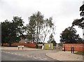
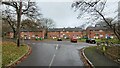
Photos of GU11 4FA


Area Information
GU11 4FA is a compact residential postcode in England, covering just 2.1 hectares and home to 2,218 people. Its high population density — 106,710 people per square kilometre — reflects a tightly knit community, though the area remains small enough to feel intimate. The cluster of homes here suggests a focus on established living, with many residents likely long-term residents. Daily life is shaped by proximity to local amenities, including shops, transport hubs, and schools. While the area lacks large-scale infrastructure, its compact nature means residents can access essentials without long commutes. The mix of housing and community services creates a functional, if modest, living environment. For those seeking a quiet, well-served residential spot with practical connectivity, GU11 4FA offers a balance of density and accessibility. Its position near transport links and retail options makes it appealing to families and professionals alike, though the small size means space is limited.
- Area Type
- Postcode
- Area Size
- 2.1 hectares
- Population
- 2218
- Population Density
- 2353 people/km²
The property market in GU11 4FA is characterised by a 45% home ownership rate, with houses making up the majority of accommodation types. This suggests the area is not a rental hotspot but rather a mix of owner-occupied and rented properties. The prevalence of houses, rather than flats or apartments, indicates a focus on traditional family homes, which may appeal to those seeking space and privacy. However, the small area size and high population density imply limited availability of new builds or larger properties. Buyers should consider the compact nature of the postcode, as expansion is unlikely. The market may cater more to first-time buyers or those seeking a secondary residence, given the modest scale of the housing stock. Proximity to amenities and transport links could enhance the area’s appeal, but potential buyers should factor in the limited spatial footprint.
House Prices in GU11 4FA
Showing 47 properties
| Address | Type | Beds | Baths | Last Sale Price | Last Sale Date | |
|---|---|---|---|---|---|---|
| 79 Hope Grants Road, Wellesley, Aldershot, GU11 4FA | Semi-detached | 4 | 2 | £535,000 | Jul 2024 | |
| 11 Hope Grants Road, Wellesley, Aldershot, GU11 4FA | Semi-detached | 4 | 2 | £484,792 | Mar 2024 | |
| 7 Hope Grants Road, Wellesley, Aldershot, GU11 4FA | house | - | - | £480,000 | Feb 2024 | |
| 9 Hope Grants Road, Wellesley, Aldershot, GU11 4FA | house | - | - | £475,000 | Jan 2024 | |
| 19 Hope Grants Road, Wellesley, Aldershot, GU11 4FA | house | - | - | £671,155 | Jun 2023 | |
| 27 Hope Grants Road, Wellesley, Aldershot, GU11 4FA | house | - | - | £515,000 | Jun 2023 | |
| 23 Hope Grants Road, Wellesley, Aldershot, GU11 4FA | house | - | - | £454,810 | May 2023 | |
| 29 Hope Grants Road, Wellesley, Aldershot, GU11 4FA | house | - | - | £521,644 | May 2023 | |
| 25 Hope Grants Road, Wellesley, Aldershot, GU11 4FA | house | - | - | £520,343 | May 2023 | |
| 31 Hope Grants Road, Wellesley, Aldershot, GU11 4FA | house | - | - | £532,500 | May 2023 |
Energy Efficiency in GU11 4FA
The lifestyle in GU11 4FA is shaped by its proximity to retail, transport, and regional travel hubs. Residents have access to five retail outlets, including major stores like Lidl Central, Iceland Aldershot, and Morrisons Aldershot, ensuring everyday shopping needs are met locally. The area’s railway stations — Aldershot, North Camp, and Ash Vale — provide frequent connections to nearby cities, while Farnborough and Blackbushe airports offer regional flight options. Though the area lacks large parks or leisure facilities, its compact size means residents can reach larger recreational spaces nearby. The mix of retail and transport options creates a practical, if modest, lifestyle, ideal for those prioritising convenience over expansive amenities. The presence of well-rated schools and reliable connectivity further enhances the appeal of daily life here.
Amenities
Schools
GU11 4FA is served by three primary schools: Talavera Junior School, Talavera Infant School, and The Cambridge Primary School. All three are rated either ‘good’ or ‘outstanding’ by Ofsted, providing a strong foundation for local education. The presence of two primary schools under the same name suggests a shared educational network, possibly serving multiple local clusters. Families in the area benefit from a consistent standard of primary education, with no secondary schools listed nearby. The mix of ‘good’ and ‘outstanding’ ratings indicates a generally high-quality educational environment, though parents may need to consider proximity to secondary schools if planning for older children. The availability of well-rated primary schools is a key draw for families prioritising education when choosing a home.
| Rank | School | Type | Entry gender | Ages |
|---|
Explore more schools in this area
Go to Schools tabDemographics
The population of GU11 4FA is predominantly adults aged 30–64, with a median age of 47. This suggests a community of working-age individuals and families, rather than a younger or elderly demographic. Home ownership here is relatively low at 45%, indicating a higher proportion of renters compared to owner-occupied homes. The area is composed mainly of houses, not flats or apartments, which aligns with the typical housing stock in smaller residential clusters. The predominant ethnic group is White, with no specific data on other demographics provided. The absence of detailed diversity statistics means the community’s composition remains largely unexplored in the data. The age profile and home ownership rate suggest a mix of long-term residents and those in transitional housing situations, though the area’s stability is reflected in its consistent population figures.
Household Size
Accommodation Type
Tenure
Ethnic Group
Religion
Household Composition
Age
Household Deprivation
NS-SEC
Explore more demographic insights in this area
Go to Demographics tabPlanning
Planning Constraints
- Flood RiskPremium
- Ramsar Wetland SitesPremium
- Area of Outstanding Natural BeautyPremium
- Protected Nature ReservePremium
- Protected WoodlandPremium