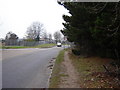
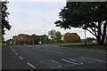
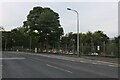
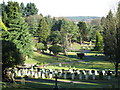
Area Overview for GU11 4FQ
Photos of GU11 4FQ


Area Information
GU11 4FQ is a small residential cluster in England, covering 14 hectares and home to 2169 residents. Its compact size and high population density of 929 people per square kilometre suggest a closely knit community, though the area’s character is shaped by its proximity to Aldershot and surrounding infrastructure. The median age of 22 contrasts with the most common age range of 30-64, hinting at a mix of younger residents and families. Daily life here is likely influenced by nearby amenities, including retail outlets, rail links, and two airports within practical reach. While the area lacks natural constraints like protected woodlands or AONBs, its connectivity to transport networks and retail hubs makes it appealing for commuters. However, the relatively low home ownership rate of 18% suggests a rental-dominated market, which may affect long-term stability for buyers. For those prioritising convenience over rural tranquillity, GU11 4FQ offers a compact, accessible living environment with clear trade-offs between density and open space.
- Area Type
- Postcode
- Area Size
- 14.0 hectares
- Population
- 2169
- Population Density
- 929 people/km²
The property market in GU11 4FQ is characterised by a low home ownership rate of 18%, suggesting that the area is primarily a rental market rather than one dominated by owner-occupied homes. The accommodation type is predominantly houses, which may appeal to families or those seeking standalone properties. However, the small size of the area—just 14 hectares—means housing stock is limited, potentially restricting options for buyers. The high population density of 929 people per square kilometre further implies that properties are closely spaced, which could affect privacy or space for larger families. For those considering purchase, the rental market’s dominance means competition may be fierce, and long-term value appreciation could depend on broader regional trends rather than local supply constraints. Buyers should also consider the area’s proximity to transport links, which may enhance its appeal for commuters.
House Prices in GU11 4FQ
Showing 30 properties
| Address | Type | Beds | Baths | Last Sale Price | Last Sale Date | |
|---|---|---|---|---|---|---|
| 13 Mandora Road, Wellesley, Aldershot, GU11 4FQ | house | - | - | £475,000 | Jun 2024 | |
| 7 Mandora Road, Wellesley, Aldershot, GU11 4FQ | house | - | - | £499,950 | Jun 2024 | |
| 41 Mandora Road, Wellesley, Aldershot, GU11 4FQ | Terraced | 3 | 2 | - | - | |
| 49 Mandora Road, Wellesley, Aldershot, GU11 4FQ | Terraced | 3 | 2 | - | - | |
| 17 Mandora Road, Wellesley, Aldershot, GU11 4FQ | house | - | - | - | - | |
| 23 Mandora Road, Wellesley, Aldershot, GU11 4FQ | house | - | - | - | - | |
| 25 Mandora Road, Wellesley, Aldershot, GU11 4FQ | house | - | - | - | - | |
| 11 Mandora Road, Wellesley, Aldershot, GU11 4FQ | house | - | - | - | - | |
| 9 Mandora Road, Wellesley, Aldershot, GU11 4FQ | house | - | - | - | - | |
| 59 Mandora Road, Wellesley, Aldershot, GU11 4FQ | house | - | - | - | - |
Energy Efficiency in GU11 4FQ
Living in GU11 4FQ offers access to a range of nearby amenities, including five retail outlets such as Co-op Aldershot, Lidl Central, and Iceland Aldershot, ensuring daily shopping needs are met. The area’s rail network, with stations like Aldershot and Ash Vale, provides easy access to commuting routes and regional travel. Proximity to Farnborough and Blackbushe airports adds convenience for those requiring frequent air travel. While the data does not specify parks or leisure facilities, the presence of multiple retail and transport hubs suggests a practical, service-oriented lifestyle. The compact nature of the area means amenities are closely clustered, reducing travel time for essentials. However, the lack of detailed information on green spaces or recreational facilities may be a consideration for those prioritising outdoor activities. Overall, the area caters to residents seeking convenience over expansive natural landscapes.
Amenities
Schools
| Rank | School | Type | Entry gender | Ages |
|---|
Explore more schools in this area
Go to Schools tabDemographics
The community in GU11 4FQ skews younger, with a median age of 22, yet the most common age group is adults aged 30-64. This suggests a mix of younger residents and families, though the overall demographic profile is not fully defined by generational splits. Home ownership is low, with only 18% of residents owning their homes, indicating a rental-heavy market. The accommodation type is predominantly houses, which may reflect a preference for standalone properties over flats. The predominant ethnic group is White, though specific data on diversity or deprivation is not provided. The high population density of 929 people per square kilometre, combined with limited home ownership, may influence the area’s social dynamics, potentially creating a transient population. For buyers, this could mean a competitive rental market and a community with evolving demographics rather than long-established local ties.
Household Size
Accommodation Type
Tenure
Ethnic Group
Religion
Household Composition
Age
Household Deprivation
NS-SEC
Explore more demographic insights in this area
Go to Demographics tabPlanning
Planning Constraints
- Flood RiskPremium
- Ramsar Wetland SitesPremium
- Area of Outstanding Natural BeautyPremium
- Protected Nature ReservePremium
- Protected WoodlandPremium