Area Overview for GU11 2LB
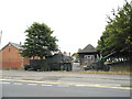
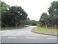
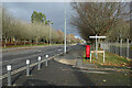
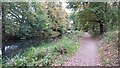
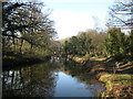
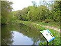
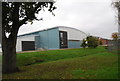
Photos of GU11 2LB

Area Information
GU11 2LB is a small, tightly packed residential postcode in England, covering just 23.5 hectares and home to 2,169 people. Its compact size means it’s a quiet, focused area with a distinct local character. The population density of 929 people per square kilometre suggests a mix of established households and newer residents, though the median age of 22 hints at a younger demographic. This contrasts with the most common age group, adults aged 30–64, indicating a balance between younger professionals and families. Daily life here is shaped by proximity to key amenities: Co-op Aldershot, Waitrose Little, and Lidl Central provide shopping options, while nearby rail stations like Aldershot and Ash Vale offer easy access to commuting routes. The area’s small footprint means it’s not sprawling, but its location near Farnborough Airport and Blackbushe Airport adds convenience for those needing travel connections. While it lacks large-scale attractions, GU11 2LB’s charm lies in its simplicity and practicality, making it a viable choice for those seeking a manageable, community-oriented lifestyle.
- Area Type
- Postcode
- Area Size
- 23.5 hectares
- Population
- 2169
- Population Density
- 929 people/km²
The property market in GU11 2LB is shaped by its low home ownership rate of 18% and the predominance of houses. This suggests that the area is not heavily driven by owner-occupation but rather by rental demand. The presence of houses rather than flats or apartments may appeal to families or individuals seeking more space, though the small area size means housing options are limited. For buyers, this could mean competition is less intense than in larger towns, but the market may be constrained by the area’s compact nature. Proximity to rail stations like Aldershot and Ash Vale could enhance property value for commuters, while nearby airports may attract professionals needing travel access. However, the low home ownership rate indicates a higher proportion of rental properties, which could affect long-term investment potential. Buyers should consider the limited local stock and explore nearby areas for broader options.
House Prices in GU11 2LB
Showing 4 properties
| Address | Type | Beds | Baths | Last Sale Price | Last Sale Date | |
|---|---|---|---|---|---|---|
| Sergeants Mess, Hammersley Barracks, Hammersley Road, Aldershot, GU11 2LB | commercial | - | - | - | - | |
| Officers Mess, Hammersley Barracks, Hammersley Road, Aldershot, GU11 2LB | commercial | - | - | - | - | |
| Army School Of Physical Training, Fox Lines, Queens Avenue, Aldershot, GU11 2LB | commercial | - | - | - | - | |
| Foxs Gymnasium, Queens Avenue, Aldershot, GU11 2LB | Leisure | - | - | - | - |
Energy Efficiency in GU11 2LB
Living in GU11 2LB offers a mix of practical amenities and limited leisure options. The retail sector is modest but sufficient, with Co-op Aldershot, Waitrose Little, and Lidl Central providing everyday shopping needs. These stores are within walking or short driving distance, making errands convenient. The area’s rail stations, including Aldershot and Ash Vale, connect residents to broader networks, while nearby airports offer easy access to regional and international travel. Parks or green spaces are not explicitly mentioned, but the absence of protected natural areas suggests a focus on residential comfort rather than outdoor recreation. The character of the area is defined by its simplicity: a place where daily life revolves around local shops, commuting, and nearby airports. While it lacks large-scale attractions, the proximity to rail and air travel compensates for the smaller scale of amenities.
Amenities
Schools
| Rank | School | Type | Entry gender | Ages |
|---|
Explore more schools in this area
Go to Schools tabDemographics
The community in GU11 2LB is predominantly composed of adults aged 30–64, with a median age of 22 suggesting a younger population also present. This mix implies a blend of established families and younger professionals. Home ownership here is relatively low at 18%, indicating that a significant portion of the housing stock is rented. The accommodation type is primarily houses, which is unusual for areas with higher rental demand. The predominant ethnic group is White, though no data is provided on other groups. The population density of 929 people per square kilometre means the area is neither densely packed nor sparsely populated, offering a balance between privacy and community interaction. The lower home ownership rate may reflect a rental market dynamic, where properties are more likely to be occupied by tenants than owners. This could influence the local economy, with fewer long-term residents invested in property values.
Household Size
Accommodation Type
Tenure
Ethnic Group
Religion
Household Composition
Age
Household Deprivation
NS-SEC
Explore more demographic insights in this area
Go to Demographics tabPlanning
Planning Constraints
- Flood RiskPremium
- Ramsar Wetland SitesPremium
- Area of Outstanding Natural BeautyPremium
- Protected Nature ReservePremium
- Protected WoodlandPremium