Area Overview for BN11 1LY
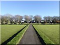
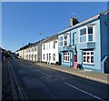
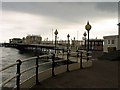
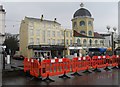
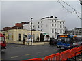
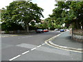
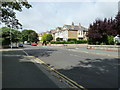
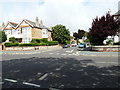
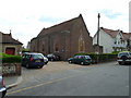
Photos of BN11 1LY
Area Information
BN11 1LY defines a compact residential cluster within the broader town of Worthing in West Sussex. This specific postcode covers an area of 1.5 hectares and supports a population of 1,207 residents. You will find BN11 1LY to be a densely packed urban neighbourhood rather than a sprawling village. The location falls under the Central Ward electoral division, which serves as an established part of the Worthing West parliamentary constituency. Daily life here is characterised by proximity to essential services within Worthing, a coastal settlement on the south coast of England. Living in BN11 1LY means residing in a concentrated spot where neighbours are likely close by due to the high density of 81,992 people per square kilometre. This intensity reflects a typical inner-urban environment where convenience outweighs open space. The area functions as a small slice of the larger town, offering quick access to the amenities found throughout Worthing. Despite its small footprint, this site integrates seamlessly with the surrounding infrastructure, providing a straightforward commute potential and easy access to local retail and transport hubs.
- Area Type
- Postcode
- Area Size
- 1.5 hectares
- Population
- Not available
- Population Density
- Not available
The housing stock in BN11 1LY is primarily composed of flats, a fact confirmed by the area's predominant accommodation type data. Only 32% of residents own their homes outright, which signals that the market is heavily weighted towards private renting rather than owner occupation. This aligns with the urban nature of postcode BN11 1LY, where small footprint homes are typical. Prospective buyers looking at BN11 1LY should expect to navigate a rental market or seek specific investment opportunities rather than finding many starter homes for purchase. The surrounding Central Ward context suggests an average new-build sale price of £277,032 and a price per square metre of £3,767 across Worthing. These figures indicate a mid-range valuation for the wider borough, positioning BN11 1LY as a cost-effective option compared to more exclusive coastal promenades. The high density of 81,992 people per square kilometre reinforces the prevalence of vertical living. If you wish to buy homes in BN11 1LY, you must target the specific flats available rather than expecting detached properties. This market composition suits investors dominating the sector and tenants seeking affordable access to coastal living without the commitment of ownership.
House Prices in BN11 1LY
Showing 36 properties
Energy Efficiency in BN11 1LY
Residents of BN11 1LY enjoy immediate access to major retail chains and transport hubs. Five retail outlets lie within practical reach, including Tesco Worthing, Waitrose Worthing, and Lidl Central. These options ensure you can handle all grocery and shopping needs without travelling far. Transport connectivity is equally convenient, with five railway stations nearby such as Worthing Railway Station and East Worthing Railway Station. You also have two airports close by, specifically Shoreham Airport and Shoreham Brighton City Airport. This network simplifies both daily commuting and occasional leisure travel. While the data does not specify local parks or leisure centres directly named for BN11 1LY, the proximity to Worthing central amenities implies access to the town's broader facilities. The area sits in the Central Ward, which forms part of the Worthing West constituency. Daily life revolves around the convenience of being near these named venues. You benefit from a lifestyle where supermarkets and trains are just moments away. The sheer number of nearby large stations and retailers like Waitrose and Tesco defines the practical quality of life here more than any dedicated local green space might.
Amenities
Schools
| Rank | School | Type | Entry gender | Ages |
|---|
Explore more schools in this area
Go to Schools tabDemographics
The community residing in BN11 1LY is defined by a mature demographic profile. The median age for residents here is 47 years, with the most common age range falling between 30 and 64 years. You are likely to encounter a population dominated by working-age adults rather than young families or retirees in their later years. Home ownership stands at 32%, a figure that indicates the majority of residents in this cluster rent their accommodation. This high rental figure is consistent with the predominant accommodation type, which consists of flats. The area maintains a predominantly White ethnic background, reflecting the broader national profile for urban centres like Worthing. With 1,207 people living on such a small 1.5-hectare plot, the noise levels and shared living spaces are inherently closer than in suburban homes. The concentration of adults in this age bracket suggests a neighbourhood where multi-generational families or sharers in flats are the norm. This demographic structure supports a quiet but active living environment where social interaction often happens within shared buildings rather than large community parks.
Household Size
Accommodation Type
Tenure
Ethnic Group
Religion
Household Composition
Age
Household Deprivation
NS-SEC
Explore more demographic insights in this area
Go to Demographics tabPlanning
Planning Constraints
- Flood RiskPremium
- Ramsar Wetland SitesPremium
- Area of Outstanding Natural BeautyPremium
- Protected Nature ReservePremium
- Protected WoodlandPremium